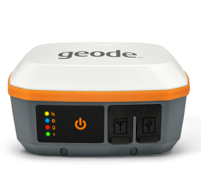
Juniper Systems Geode GNS3S Single Frequency GNSS Receiver
Quick Overview
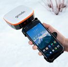
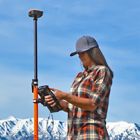
The next-generation Geode™ GNS3 GNSS Receiver from Juniper Systems is a real-time, scalable GNSS receiver, available in single frequency and multi-frequency antenna configurations. As the most accurate Geode to date, the GNS3S allows users to easily collect real-time GNSS data with sub-meter, sub-foot, and decimeter accuracy options – without the huge price tag or complexity of other precision receivers. 9-pin serial port. Geode GNS3 is designed to interface with Juniper Systems and third-party field data collection systems. Compatible with all operating systems.
GNSS Fixed Single Frequency configuration. Upgradeable to add 10Hz or 20Hz data output rates. NOT UPGRADEABLE to Multi-Frequency.
The Geode GNS3 offers:
- Scalable accuracy
- Open interface (Works with Windows®, iPhone® and iPad®, and Android™ devices)
- All-day battery life
- One-button simplicity
- Compact size
- All-in-one design
- Affordable price points
- Juniper Rugged™
SKU
GNS3S-CFG-13817
In stock
$2,495.00

FEATURES
- Scalable Accuracy - The Geode GNS3 provides sub-meter, sub-foot, and decimeter accuracy options. This makes the Geode an ideal option for field applications including Geological surveys, Wetland management, Assessments along with Wetland and Water delineations.
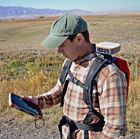
- Open Interface (BYOD) - Use Geode with any of Juniper Systems' handhelds or with your own iPhone™, iPad™, Windows®, or Android™ device. This cross platform capability allows the Geode to fit into any pre-existing workflow making it a perfect addition for anyone including: the U.S. Forest Service, any Game and Fish Department, the United States Geological Society, the Bureau of Land Management, the Geological Society of America and many more.
- All-day Battery Life - The Overtime Technology battery provides enough power for long workdays, while conserving power in extreme temperatures. The All-day battery life allows the Geode to consistently and reliably log data for Corrosion and Cathodic Protection, Abandoned Well Locating, Landscape Water Management, Paleontology Sites, Pipeline Locating, Resource Conservation or for any other Environmental or Geotechnical need
- Simple to Use - It's "one button simple" design provides intuitive and easy operation. The functionality of this simple to use device also makes it ideal for those just learning or new to field of Geospatial Data collection. A perfect candidate for use in Colleges and Universities along with Natural History Museums, Preservation Societies, Historical Societies, Wildlife Preserves and Hunting/Big Game Ranches.
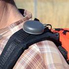
- Compact Size - Small and lightweight, the Geode is easy to pack around all day. Perfect for use in Ecological Restoration, Wildlife Conservation, Archaeology, Historic Preservation, Wildfire Planning and Containment Delineation for Soil and Crop Sciences.
- All-In-One Design - The inside of the Geode contains the receiver, antenna, and battery, making it easy to carry around and mount without a mess of wires. With the easy-to-use and portable design the Geode has quickly become a favorite in Transportation Planning including Highway, Aviation and Rail Construction, Utilities Services such as location collecting, asset management, Traffic Sign Inventory, Telecommunications, Pipe Contractors and other Mapping Solutions using KMZ, KML and Shapefiles.
- Affordable Price Points - Professional accuracy at a price you can afford. The high level of accuracy offered combined with an affordable price point creates an ideal product for use in the Irrigation and Drainage Industries, Environmental Protection and Management, Geophysical Services, Cartography, Environmental Sciences, Ecological/Site Restoration, Environmental Remediation, Cultural Resource Assessment and Costal Zoning.
- Juniper Rugged™ - Designed to withstand harsh environments for consistently reliable performance. The sturdy construction makes the Geode an ideal option for use in marking Jurisdictional Waters, Habitat Restoration, Threatened and Endangered Species Assessments, Trail Assessment, design and maintenance as well as Landscape Water Management.
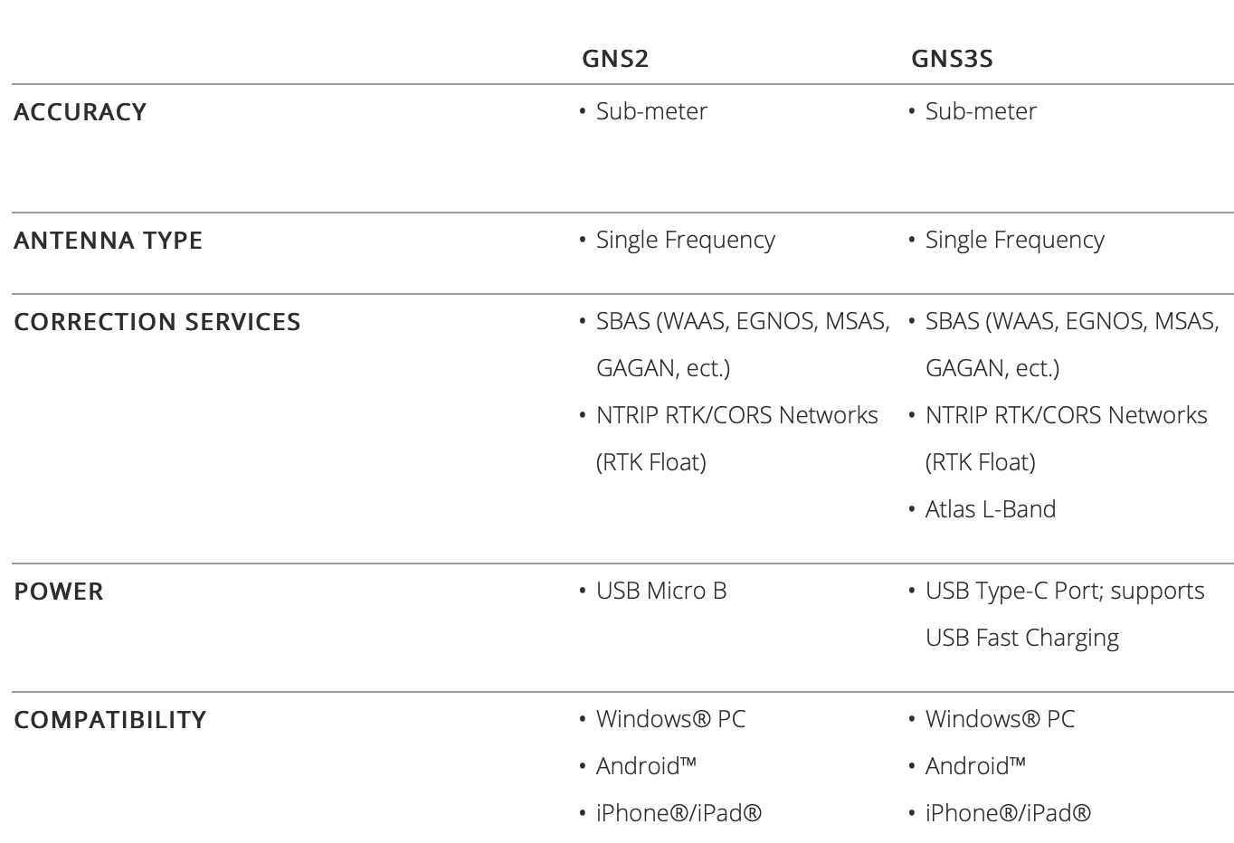
GEODE GNSS RECEIVER COMPARISON
This comparison guide outlines the differences between the Geode GNS2 and Geode GNS3.
Related Products