877.309.4099
 Contact Sales
 877.309.4099
 Contact Sales
-
Sold outRegular price $4,560.00Regular priceUnit price per
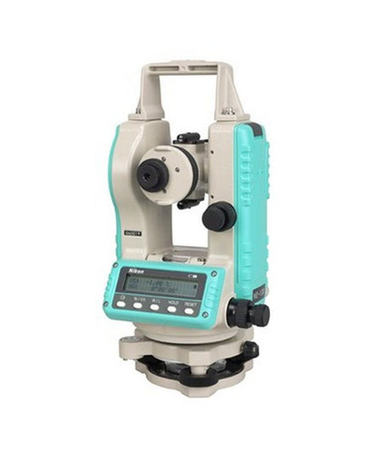
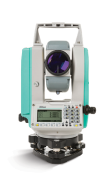
Nikon NE-101 Digital Theodolite
Ease of use, reliability, and durability make the Nikon NE-101 theodolite a smart choice for your general construction, alignment and layout applications. Ideal for concrete form alignment, anchor bolt positioning, and steel column erection. The theodolite enables a number of positioning techniques: 90-degree layout, checking angles, alignment and plumb, as well as short range grade work and leveling.Sold out -
Regular price $1,020.00Regular priceUnit price per
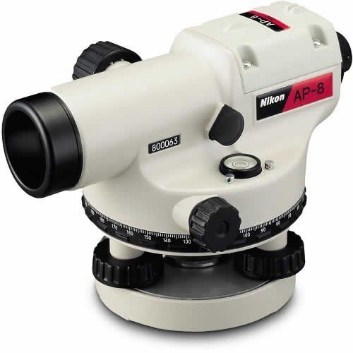
Nikon AP-8 Automatic Level, 360 Degrees, 28X
The Nikon AP-8 automatic level features a 28x telescope with a 30mm objective lens for clear, bright images in an erect and unreversed orientation. With a built-in compensator, it automatically levels the line of sight over a wide compensation range of ±16 inches with a setting accuracy of ±0.5 inch. -
Regular price $555.00Regular priceUnit price per
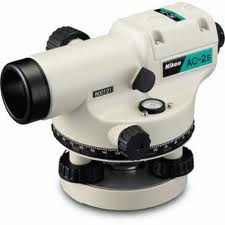
Nikon AC-2S 24X Automatic Level (360 degree)
The Nikon AC-2S 24x telescope has a 30mm objective lens for clear, bright images in an erect and unreversed orientation. The built-in compensator automatically levels the line of sight over a wide compensation range of ±16 inches with a setting accuracy of ±0.5 inch and minimum focusing distance of 0.75 meters/2.46 feet, standard deviation for a 1-km double-run level is just ±2.5mm. HGA42210. -
Record the tally, Map the joints, Merge tally and join mapping, Survey the Pipeline, Pipeline COGO, and use for reporting. ONLY AVAILABLE FOR OUR CUSTOMERS IN TEXAS, OKLAHOMA AND ARIZONA This is a downloadable product and No Media will be shipped. (An AllTerra Central Salesperson will contact after purchase and provide an installation code.)
-
-
-
-
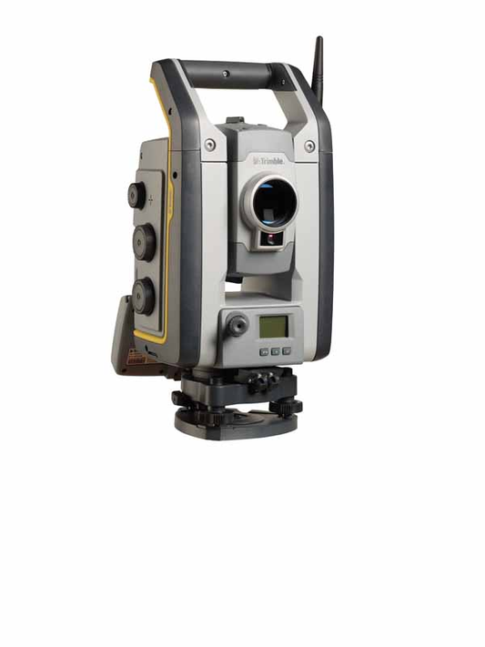
The Trimble S5 Total Station provides the foundation for Trimble’s Integrated Surveying™ solutions. With Integrated Surveying, you can seamlessly integrate complementary technologies on the job site, such as Trimble GNSS receivers and optical measurements.Rent Now
-
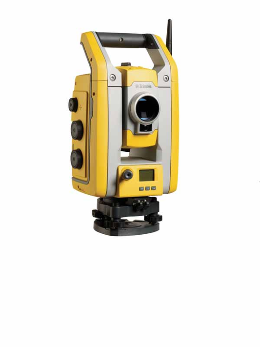
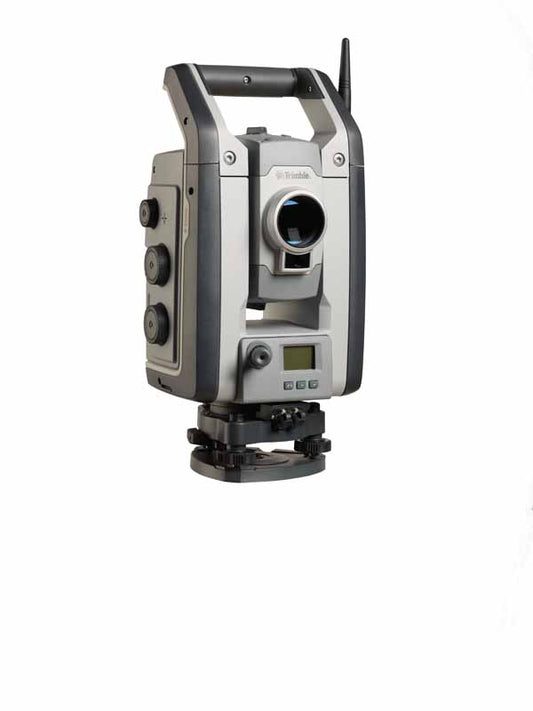
Trimble S7 Total StationRent Now
-
Trimble S7 Total StationRent Now
-
Trimble S9 Total StationRent Now
-
The Trimble® X7 3D Laser Scanner is a compact, lightweight system with new innovations to simplify adoption, increase efficiency and provide confidence in the field. Automatic Calibration ensures data accuracy on each scan and Registration Assist enables automatic in field registration. With the Trimble X7 and Trimble Perspective field software, you get a dependable instrument backed by an industry-leading two year warranty and comprehensive workflows to validate scan projects in the field. CONTACT SALESPERSON HERE ONLY AVAILABLE FOR DELIVERY IN TEXAS, OKLAHOMA AND ARIZONA. 3D Scanner Comparison Chart HereRent Now
-
The Trimble X9 3D Laser Scanner has proven innovations like automatic calibration, self-leveling and a laser pointer plus enhanced range, accuracy, and speed to do jobs better and faster. See the available kits with Trimble Perspective software for a complete system with powerful in field registration workflows and full project visibility to validate projects in the field. Trimble X9 bring your own device kit with Perspective software, carbon fiber tripod, quick release and backpack. KIT INCLUDES: X9 Kit with T10x Tablet (X9-100-00-T10X) T10 Battery, Enhanced Capacity -11.4V, 7980 mAh (114111) T10 Battery Charger Kit / single battery (114113) BAT Lithium-ion 11.1V 5000mAH 55.5Wh Size-Custom Smart Rigel (99511-30) includes - (1) X9 w/ 3 batteries & SD Card, (1) Hard X9 Case & (1) Soft X9 Case, (1) T10x Tablet w/ 2 Batteries and Charger, (1) Gitzo TripodRent Now
-
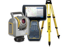
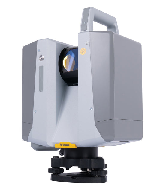
The Trimble X12 3D Laser Scanning System, an accessible high-end 3D laser scanning system with superior speed, accuracy, range, and incredible image clarity. 3D laser scanning has evolved. The Trimble® X12 scanning system unites the best of both worlds with industry-leading hardware and Trimble’s powerful, ultra-efficient Trimble Perspective software for guaranteed peak performance. No more complicated workflows. No complex registration process. No compromises in accuracy, speed, range, or imaging. Accessible Simple field workflows suitable for all users. Trimble® Perspective software to auto-register, refine and export scan data in the field. Clearly view and validate scans and images on the fly. Leave the field with confidence the project is complete. Productive Collect superior scan data and imagery faster than ever. Speed, accuracy and range to effectively complete any job ahead of schedule. Unmatched HDR image quality and integrated LED spots to capture dark environments. Quickly produce indisputable results to satisfy the most demanding requirements. Dependable State-of-the-art technology for reliable scan and image acquisition. Robust IP54 rating and industry- leading 2-year standard warranty. Flexible operation with tablet or onboard user interface. Integration with Trimble and non-Trimble software. CONTACT SALESPERSON HERE ONLY AVAILABLE FOR DELIVERY IN TEXAS, OKLAHOMA AND ARIZONA.Rent Now
-
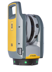
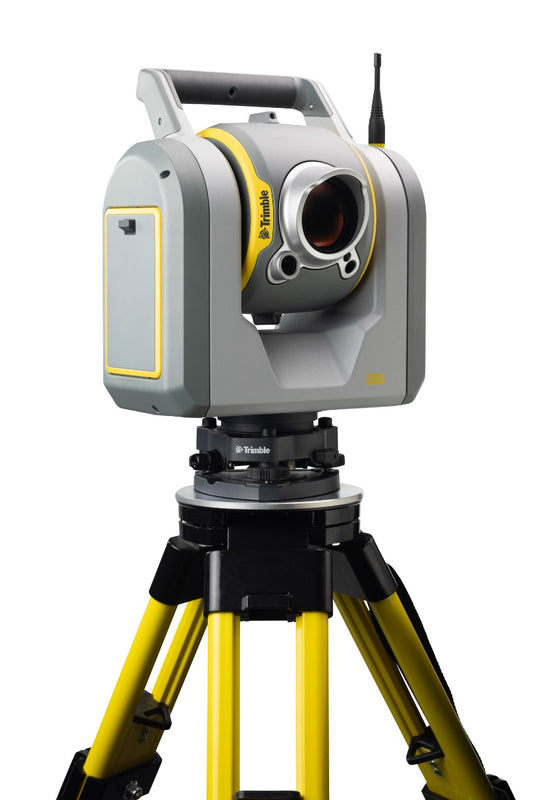
A new model of the Trimble® SX12 scanning total station is now available with Wi-Fi HaLow™ radio technology. With the addition of Wi-Fi HaLow technology, the SX12 can achieve long-range communication using a single radio link, while maintaining a robust and quick connection. CONTACT SALESPERSON HERE ONLY AVAILABLE FOR DELIVERY IN TEXAS, OKLAHOMA AND ARIZONA.Rent Now
-
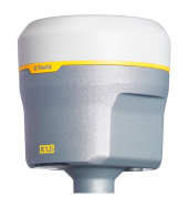
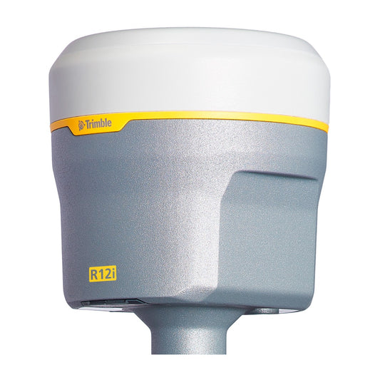
Designed to help surveying professionals work more effectively, the Trimble® R12i receiver represents the next generation of GNSS surveying. With powerful technologies that go beyond comprehensive GNSS support, including the industry-leading Trimble ProPoint™ RTK engine and Trimble TIP™ tilt compensation, the R12i delivers unmatched GNSS performance, speed and accuracy to boost productivity for land surveyors.Trimble® R12i — a new angle of productivity.Industry-leading Trimble® ProPoint™️ positioning engine for unmatched performance and flexibility. Use any and all available GNSS constellations & signalsIncreased accuracy, reliability, and productivity in challenging environmentsAll-new Trimble TIP™️ IMU-based tilt compensation technologyField-proven, ergonomic design housing the latest Trimble GNSS hardwareIncludes:R12i, Model 60, ROW (NEW)Trimble Dual Battery Charger(x2) R12i Rechargeable BatteriesR12i Quick Release R12i UHF Radio AntennaR12i Rugged Transport CaseCONTACT SALESPERSON HEREONLY AVAILABLE FOR DELIVERY IN TEXAS, OKLAHOMA AND ARIZONA.Rent Now
-
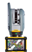
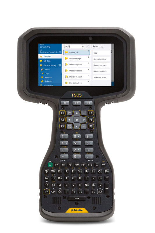
The Trimble® TSC5 controller is an Android-based survey controller featuring a five-inch screen and full keyboard—ensuring fast, efficient operation, even while wearing gloves. Rugged yet lightweight, with all-day battery power, the TSC5 is easy to carry and easy to use. Combined with Trimble Access™ software to do precise field data collection, the TSC5 offers the ideal blend of high performance and reliability you expect from Trimble. Features: Backlit alphanumeric keypad helps data entry, even in tough conditions 5-inch touchscreen Google Mobile Services Connectability for efficient data collection Android™ 10 operating system. Android operating system GMS Certified with Google Tools and Play Store 12 programmable function keys and Shift & AGr key combinations Ergonomic design, lighter weight and easy to grip means less onsite fatigue Brightly lit, anti-glare screen is easy to use and helps you get more done even in low light conditions All day battery, backed up by a removable battery option helps you power through the day Rugged and reliable, IP65 rated, means it comes into its own in tough locations Compare the key enhancements of the Trimble TSC5 over the TSC3 here THIS VERSION DOES NOT INCLUDE TRIMBLE ACCESS SOFTWARE ONLY AVAILABLE FOR DELIVERY IN TEXAS, OKLAHOMA AND ARIZONA.Rent Now

Item added to your cart