877.309.4099
 Contact Sales
 877.309.4099
 Contact Sales
-
Regular price $2,995.00Regular priceUnit price per
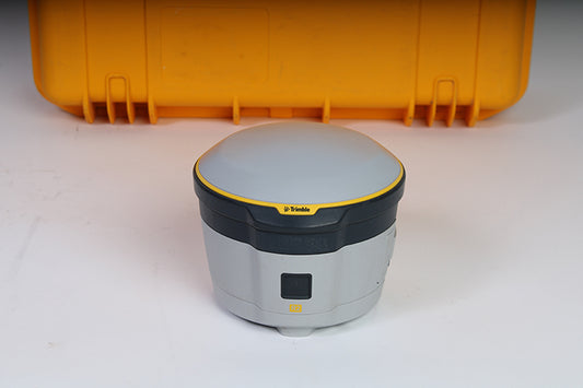
Used Trimble R2 GNSS Receiver - Decimeter
The Trimble R2 is Used and in good condition. The Trimble R2 has dual frequency GPS tracking, GLONASS, Galileo and BeiDou enabled. This receiver does not have the internal UHF Radio enabled. Tested by a Certified Trimble technician and ready to use in the field. Click to order or call us at 877-300-9659 if you have any questions (mention you saw it on the website).
Trimble R2 Includes:
- Used Trimble R2 – Decimeter (10cm/10cm Precision)
- Dual Charger with power supply
- Two batteries
- Transport Case
NOT AVAILABLE FOR DELIVERY IN CALIFORNIA.
-
-
-
-
-
-
-
Rent Now
Juniper Systems Geode GNS3 is a real-time, scalable GNSS receiver, available in single frequency and multi-frequency antenna configurations. The Geode GNS3M can be upgraded to Multi-Frequency (L1,L2,L5) and Atlas L-Band corrections subscriptions. 9-pin serial port included on all models. Geode GNS3 is designed to interface with Juniper Systems and third-party field data collection systems. Compatible with all operating systems.
Upgradeable Single Frequency configuration. Upgradeable to 10Hz or 20Hz data rates. Upgradeable to Multi-Frequency (L1,L2,L5). Multi-Frequency required to use Atlas H30 and H10 L-Band correction subscriptions.
-
Rent Now
Juniper Systems Geode GNS3 is a real-time, scalable GNSS receiver, available in single frequency and multi-frequency antenna configurations. The Geode GNS3M can be upgraded to Multi-Frequency (L1,L2,L5) and Atlas L-Band corrections subscriptions. 9-pin serial port included on all models. Geode GNS3 is designed to interface with Juniper Systems and third-party field data collection systems. Compatible with all operating systems.
Includes Multi-Frequency (L1,L2,L5) upgrade. Upgradeable to 10Hz or 20Hz data rates. Multi-Frequency required to use Atlas H30 and H10 L-Band correction subscriptions.
-
Rent Now
The next-generation Geode™ GNS3 GNSS Receiver from Juniper Systems is a real-time, scalable GNSS receiver, available in single frequency and multi-frequency antenna configurations. As the most accurate Geode to date, the GNS3S allows users to easily collect real-time GNSS data with sub-meter, sub-foot, and decimeter accuracy options – without the huge price tag or complexity of other precision receivers. 9-pin serial port. Geode GNS3 is designed to interface with Juniper Systems and third-party field data collection systems. Compatible with all operating systems. GNSS Fixed Single Frequency configuration. Upgradeable to add 10Hz or 20Hz data output rates. NOT UPGRADEABLE to Multi-Frequency. The Geode GNS3 offers: Scalable accuracy Open interface (Works with Windows®, iPhone® and iPad®, and Android™ devices) All-day battery life One-button simplicity Compact size All-in-one design Affordable price points Juniper Rugged™
-
Rent Now
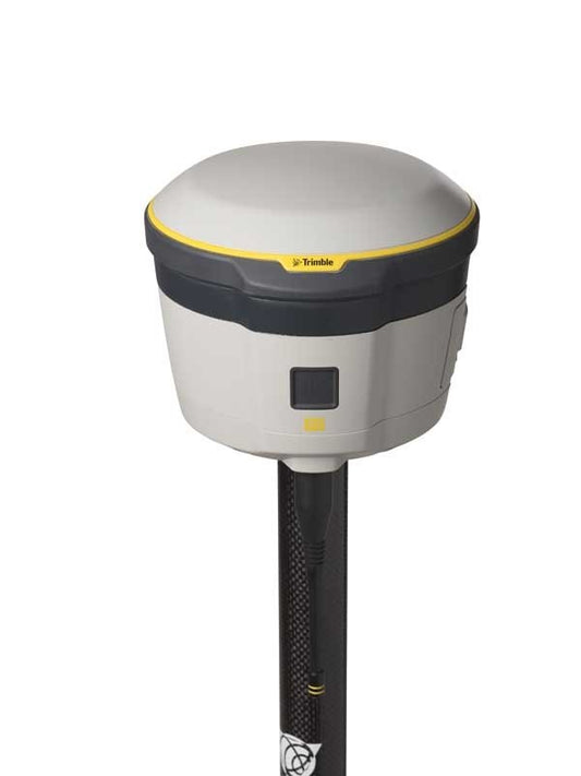
The Trimble® R2 is a compact, durable GNSS receiver that provides an easy-to-use solution for GIS professionals who need to collect accurate data in a wide range of geospatial applications. Capable of delivering Sub-Meter positioning accuracy in real-time to any mobile device via a wireless Bluetooth® connection, the R2 receiver lets you work the way you want.
- Sub-Meter solution for GIS applications at a competitive price
- Easily collect data by pairing with devices such as smartphones, tablets or Trimble handhelds
- Fast to setup, easy-to-use, keeping you productive and focused on your work
- Supports the GPS satellite constellation and SBAS correction source for accurate data at any location
- Compact, cable-free design with integrated antenna
RTK Precision: 50 cm Horizontal
Channels: 220
Antenna: Integrated
UHF Radio: NoONLY AVAILABLE FOR DELIVERY IN TEXAS, OKLAHOMA, NEW MEXICO AND ARIZONA.
-
Rent Now
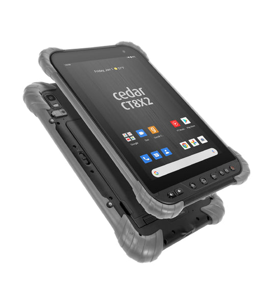
Juniper Systems’ Cedar line of rugged android tablets and smartphones offer users an upgrade in durability and performance when a consumer tablet just won’t cut it. Designed for all-day use in any environment, the CT8X2 offers impressive processing power running on an Android™ 10 operating system.
- Water and dust resistant
- All-day battery life
- Impressive processing power
- Sleek rugged design
- Optional barcode or RFID reader
- Unbeatable customer care
-
Rent Now
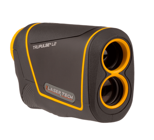
The TruPulse® L2 versatile handheld laser measures much more than just distance. Measure slope distance and inclination angle and calculate horizontal distance, vertical distance, height and 2D vertical missing line values.
The L2 is more accurate and provides calculations not found on recreational rangefinders giving you the ability to produce professional results. Take advantage of Laser Tech’s Advanced Targeting Modes (Closest, Farthest, Continuous and Filter) and TruTargeting technology so you know exactly what accuracy level is being achieved.
-
Regular price $1,995.00Regular priceUnit price per
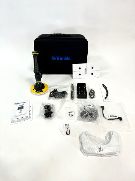
Used Trimble SiteVision - Refurbished
The Trimble SiteVision Integrated Positioning System is the Trimble handheld device that integrates the Trimble Catalyst DA1 Antenna (high precision GNSS), with Electronic Distance Measurement (EDM) Laser Rangefinder, and power management. The power management system provides power to the Trimble Catalyst DA1, the EDM, and your Android mobile phone running the SiteVision application. Software sold separately by monthly or annual subscription. Click to order or call us at 877-300-9659 if you have any questions (mention you saw it on the website).
Trimble SiteVision Hardware Included:- 1 x SiteVision Integrated Positioning System (Trimble Catalyst DA1 Antenna)
- 1 x Sun shade
- 1 x Pole Mount Adapter
- 1 x USB C to USB C Cable
- 2 x Batteries
- 1 x Charger
- 2 x Adhesive Phone Mount Plates
- 1 x Phone Mount Plate Guide
- 1 x Carry Case
NOT AVAILABLE FOR DELIVERY IN CALIFORNIA.
-
Regular price $1,295.00Regular priceUnit price per
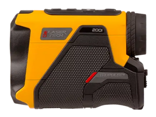
TruPulse 200i Laser Rangefinder
- Increased range & inclination accuracy for greater confidence.
- Better target discrimination with TruTargeting modes.
- Ultra-bright adjustable display for any lighting conditions and 80% light transmission for greater
- Faster acquisition and greater accuracy means reliability, efficiency, and safety.
- Rugged and waterproof design allows for use in harsh weather conditions.
- Wireless connection and compatible with all mobile devices
-
Quote Now
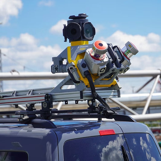
The Trimble® MX90 system is part of a complete field-to-finish mobile mapping solution that combines leading-edge hardware with intuitive field software and an integrated office software workflow. Leverage your large-scale mobile mapping projects with the Trimble MX90, which delivers unmatched GNSS performance in challenging urban and rural environments from the Trimble ProPoint® engine.
-
SiteVision Mobile AR Unlimited Per Month - Subscription
Restrictions: ONLY AVAILABLE FOR DELIVERY IN TEXAS, OKLAHOMA AND ARIZONA.
Sold out -
Regular price $695.00Regular priceUnit price per
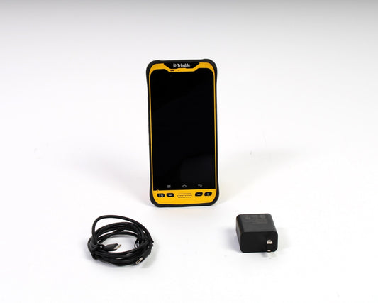
Used Trimble TDC600 Model 1 - No SW
The Trimble TDC600 data collector is used and in good condition. The Trimble TDC600 has 64GB of storage and comes with Android version 8.0.0. This Trimble TDC600 does not include any survey software. Tested by a Certified Trimble technician and ready to use in the field.
Trimble TDC600 Kit includes:
- Trimble TDC600
- Soft Carrying Pouch
- Power Supply
- USB-C Cable for Charging and Data Transfer
NOT AVAILABLE FOR DELIVERY IN CALIFORNIA.
-
Regular price $1,495.00Regular priceUnit price per
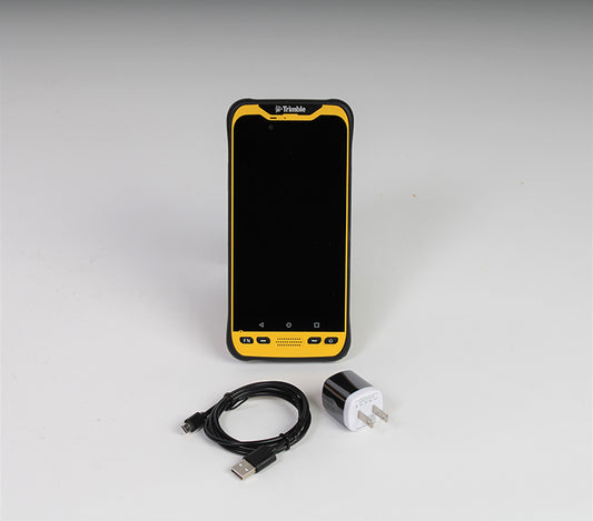
Used Trimble TDC600 Model 2 - No SW
The Trimble TDC600 Model 2 data collector is used and in good condition. The Trimble TDC600 Model 2 has 64GB of storage and comes with Android Version 10. This Trimble TDC600 Model 2 does not include any survey software. Tested by a Certified Trimble technician and ready to use in the field. Includes a 30-Day Warranty. Click to order or call us at 877-300-9659 if you have any questions (mention you saw it on the website).
Trimble TDC600 Model 2 Kit includes:
- Trimble TDC600 Model 2
- Power Supply
- USB-C Cable for Charging and Data Transfer
NOT AVAILABLE FOR DELIVERY IN CALIFORNIA.
-
Powerful app for field survey and high accuracy GIS data collection
The Trimble® Penmap for Android mobile application is a powerful, yet incredibly straightforward, cloud-connected application for cadastral field surveying and high-accuracy GIS data collection. Penmap is designed to provide both professional surveyors and field workers with a reliable and complete data collection application.
Easy to use
Easy-to-use, interactive, and map-based user interface - enabling a broader set of the community to aid in data collection
GIS
• Support of spatial and non-spatial features• Land Administration Domain Model (LADM) and Social Tenure Domain Model (STDM) compliance -adhering to international Fit-For-Purpose Land Administration standards• Streamlined forms to collect tenure data e.g. person, parties, signatures, pictures etc.
Expires monthly from invoice date.ONLY AVAILABLE FOR OUR CUSTOMERS IN TEXAS, NEW MEXICO, OKLAHOMA AND ARIZONA
This is a downloadable product and No Media will be shipped.
(An AllTerra Central Salesperson will contact after purchase and provide an installation code.)