 877.309.4099
 Contact Sales
 877.309.4099
 Contact Sales


All
Trimble eCognition Software
Trimble eCognition Software
Special Order
Trimble eCognition enables you to accelerate and automate the interpretation of your geospatial data products by allowing you to design your own feature extraction and change detection solutions. With more than 20 years of feature extraction experience, Trimble have pioneered object-based analysis techniques and continue to push the envelope of data fusion and integrated analyses. Watch eCognition TV to learn more here. ONLY AVAILABLE FOR OUR CUSTOMERS IN TEXAS, NEW MEXICO, OKLAHOMA AND ARIZONA This is a downloadable product and No Media will be shipped.
(An AllTerra Central Salesperson will contact after purchase and provide an installation code.)

Share this product


Driven by Object-based Analysis
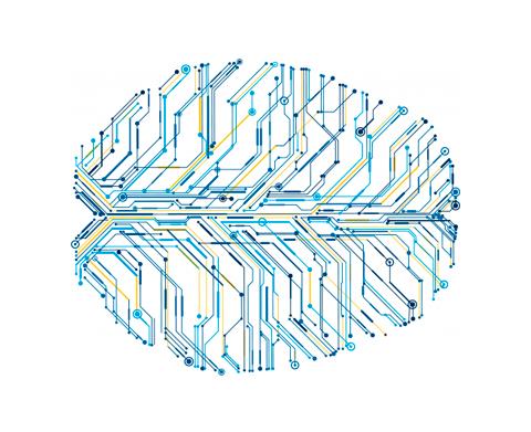
eCognition makes a radical departure from conventional approaches to data analysis due to its ability to emulate the human mind's cognitive powers and fuse geospatial input data. Using patented segmentation and classification processes, we have developed a robust method of rendering knowledge in a semantic network. The technology examines pixels/ points not in isolation, but in context. It builds up a picture iteratively, recognizing groups of pixels as objects. Just like the human mind, it uses the color, shape, texture and size of objects as well as their context and relationships to draw the same conclusions and inferences as an experienced analyst, but adding the advantages of automation and standardization. Though somewhat simplified, the following example illustrates the basic principles.
With the addition of a knife and fork, the circle is immediately recognized and classified as a plate. The circular object hasn't changed, but the human mind uses context and relationships with other objects to make intelligent inferences about the objects it perceives. And this is precisely how eCognition works.
Dynamic Analysis
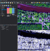
eCognition classifies and analyzes imagery, vectors and point clouds using all the semantic information required to interpret it correctly. Rather than examining stand-alone pixels or points, it distills meaning from the objects' connotations and mutual relationships, not only with neighboring objects but throughout various input data.
Of course, it also recognizes pixel information. Machine learning and deep learning approaches can be easily integrated into automated workflows. However, it adds significant value to this information by creating a powerful cognition network in a series of iterative segmentation and classification steps.This dramatically enhances the value of intelligence and information extracted from the data. What's more, the extracted information is fully quantified and qualified to meet the user's specific demands.
To build an analysis solution, it is possible to flexibly combine the image interpretation steps like object creation (segmentation), object classification (knowledge based, fuzzy logic, machine learning), object detection (template matching) and object modification (fusing, smoothing, orthogonalization, simplification) into a Rule Set or even a new application (Rule Set with UI) to solve the analysis problem. The result is a unique approach to translate mind models (why a human interpreter can see the objects, changes, or features in the geospatial data) into computer understandable code (Rule Set) or an individual/customized application.
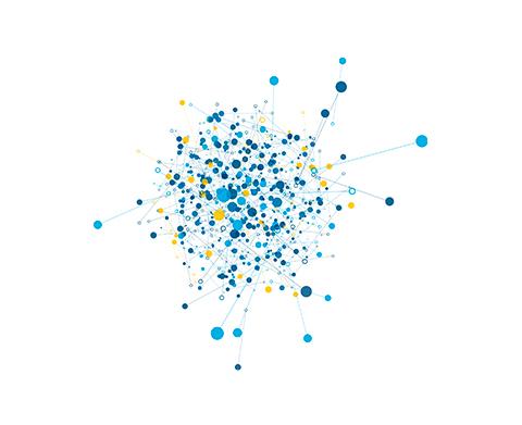
Data Fusion
eCognition can fuse a variety of geospatial data, such as spectral raster data, 3D point cloud data and thematic data from GIS vector layers. Images can speak to point clouds, vectors to images and all three to one another. User can leverage the full power of their input data independent of data type and source.
eCognition Products
Trimble eCognition is an advanced analysis software for geospatial applications. It is designed to improve, accelerate and automate the interpretation of a variety of geospatial data and enables users to design feature extraction of change detection solutions to transform geo-data into to geo-information.
The eCognition Suite offers three different components which can be used stand-alone or in combination to solve even the most challenging image analysis tasks.
eCognition Suite Products
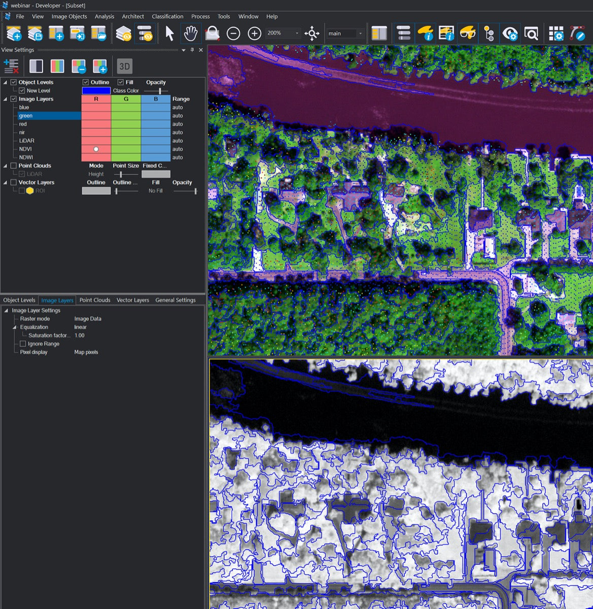
- eCognition Developer is a powerful development environment for object-based image analysis. It is used in earth sciences to develop rule sets (or applications for eCognition Architect) for the automatic analysis of remote sensing data.
- eCognition Server software provides a processing environment for batch processing and accelerated rule set development and transferability testing.
- eCognition Architect enables non-technical professionals such as vegetation mapping experts, urban planners or foresters to leverage eCognition technology. Users can easily configure, calibrate and execute image analysis workflows created in eCognition Developer.

Driven by Object-based Analysis
eCognition makes a radical departure from conventional approaches to data analysis due to its ability to emulate the human mind's cognitive powers and fuse geospatial input data. Using patented segmentation and classification processes, we have developed a robust method of rendering knowledge in a semantic network. The technology examines pixels/ points not in isolation, but in context. It builds up a picture iteratively, recognizing groups of pixels as objects. Just like the human mind, it uses the color, shape, texture and size of objects as well as their context and relationships to draw the same conclusions and inferences as an experienced analyst, but adding the advantages of automation and standardization. Though somewhat simplified, the following example illustrates the basic principles.
With the addition of a knife and fork, the circle is immediately recognized and classified as a plate. The circular object hasn't changed, but the human mind uses context and relationships with other objects to make intelligent inferences about the objects it perceives. And this is precisely how eCognition works.
Dynamic Analysis
eCognition classifies and analyzes imagery, vectors and point clouds using all the semantic information required to interpret it correctly. Rather than examining stand-alone pixels or points, it distills meaning from the objects' connotations and mutual relationships, not only with neighboring objects but throughout various input data.
Of course, it also recognizes pixel information. Machine learning and deep learning approaches can be easily integrated into automated workflows. However, it adds significant value to this information by creating a powerful cognition network in a series of iterative segmentation and classification steps.This dramatically enhances the value of intelligence and information extracted from the data. What's more, the extracted information is fully quantified and qualified to meet the user's specific demands.
To build an analysis solution, it is possible to flexibly combine the image interpretation steps like object creation (segmentation), object classification (knowledge based, fuzzy logic, machine learning), object detection (template matching) and object modification (fusing, smoothing, orthogonalization, simplification) into a Rule Set or even a new application (Rule Set with UI) to solve the analysis problem. The result is a unique approach to translate mind models (why a human interpreter can see the objects, changes, or features in the geospatial data) into computer understandable code (Rule Set) or an individual/customized application.
Data Fusion
eCognition can fuse a variety of geospatial data, such as spectral raster data, 3D point cloud data and thematic data from GIS vector layers. Images can speak to point clouds, vectors to images and all three to one another. User can leverage the full power of their input data independent of data type and source.
eCognition Products
Trimble eCognition is an advanced analysis software for geospatial applications. It is designed to improve, accelerate and automate the interpretation of a variety of geospatial data and enables users to design feature extraction of change detection solutions to transform geo-data into to geo-information.
The eCognition Suite offers three different components which can be used stand-alone or in combination to solve even the most challenging image analysis tasks.
eCognition Suite Products
- eCognition Developer is a powerful development environment for object-based image analysis. It is used in earth sciences to develop rule sets (or applications for eCognition Architect) for the automatic analysis of remote sensing data.
- eCognition Server software provides a processing environment for batch processing and accelerated rule set development and transferability testing.
- eCognition Architect enables non-technical professionals such as vegetation mapping experts, urban planners or foresters to leverage eCognition technology. Users can easily configure, calibrate and execute image analysis workflows created in eCognition Developer.


