877.309.4099
 Contact Sales
 877.309.4099
 Contact Sales
-
Sold outRegular price $1,590.00Regular priceUnit price per
Trimble PowerLines
The Trimble® Power Line application provides a streamlined workflow to measure and estimate the sag of a power line without shooting the cable. It provides a conventional survey workflow to record points on both power pole and line. The wizard-based workflow in the Power Line software helps you define key points on the power pole. Key points are trigger points that can be used to, for example, automatically create a virtual plane between points on two power poles or launch a co-ordinate geometry calculation. ONLY AVAILABLE FOR OUR CUSTOMERS IN TEXAS, OKLAHOMA AND ARIZONA This is a downloadable product and No Media will be shipped. (An AllTerra Central Salesperson will contact after purchase and provide an installation code.)Sold out -
Sold outRegular price $2,173.00Regular priceUnit price per
Trimble PowerLines Software
Review auto scanned and manually measured points and review set out points. You can generate reports for your surveyed tunnel while in the field. Use these reports to check data in the field, or to transfer data from the field to your client or to the office for further processing with office software. ONLY AVAILABLE FOR OUR CUSTOMERS IN TEXAS, OKLAHOMA AND ARIZONA This is a downloadable product and No Media will be shipped. (An AllTerra Central Salesperson will contact after purchase and provide an installation code.)Sold out -
You can generate reports for your surveyed mine while in the field. Use these reports to check data in the field, or to transfer data from the field to your client. ONLY AVAILABLE FOR OUR CUSTOMERS IN TEXAS, OKLAHOMA AND ARIZONA This is a downloadable product and No Media will be shipped. (An AllTerra Central Salesperson will contact after purchase and provide an installation code.)Sold out
-
Sold outRegular price $1,897.40Regular priceUnit price per
Trimble LandSeismic
Use Job files and planning files directly from GPSeismic and easily export postplot details into GPSeismic.Sold out -
Sold outRegular price $3,577.50Regular priceUnit price per
Trimble Business Center
The Trimble Business Center (TBC) - Intermediate Edition offers full GNSS data processing from GPS, GLONASS, BeiDou, Galileo and QZSS systems. ONLY AVAILABLE FOR DELIVERY IN TEXAS, OKLAHOMA AND ARIZONA.Sold out -
Seco Snap-Loc Button Kit, ReplacementSold out
-
Sold outRegular price $5,257.60Regular priceUnit price per
Trimble Business Center Complete Network License
Designed for advanced surveying workflow offering corridor design capabilities for road construction process. The Advanced edition offers effective tools for your most advanced CAD designs as well as features that enable users to perform photogrammetric measurements from Trimble Vision instruments including the Trimble V10 Imaging Rover. ONLY AVAILABLE FOR DELIVERY IN TEXAS, OKLAHOMA AND ARIZONA.Sold out -
Sold outRegular price $3,816.00Regular priceUnit price per
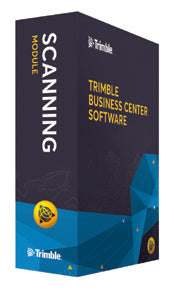
Trimble Business Center Scanning Module
Add the Trimble Business Center Scanning (TBC) Module to your existing Complete/Advanced Network License. With the new Scanning Module users can easily integrate rich point cloud and image data from the new Trimble SX10 Scanning Total Station and other industry-standard point cloud formats within familiar workflow processes. This optional module includes powerful tools to efficiently manage, view and extract quality information from point cloud data, enabling professionals to rapidly generate client deliverables with confidence. (Requires HASP key ID; Match # of seats) ONLY AVAILABLE FOR OUR CUSTOMERS IN TEXAS, OKLAHOMA AND ARIZONA This is a downloadable product and No Media will be shipped. (An AllTerra Central Salesperson will contact after purchase and provide an installation code.)Sold out -
Regular price $134.09Regular priceUnit price per
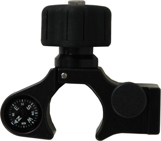
SECO Claw Pole Clamp with Compass
The Claw™ Series is designed to prevent the user from over tightening the pole clamp screw and accidentally crushing or cracking the pole. Comes with compass. -
Regular price $89.25Regular priceUnit price per
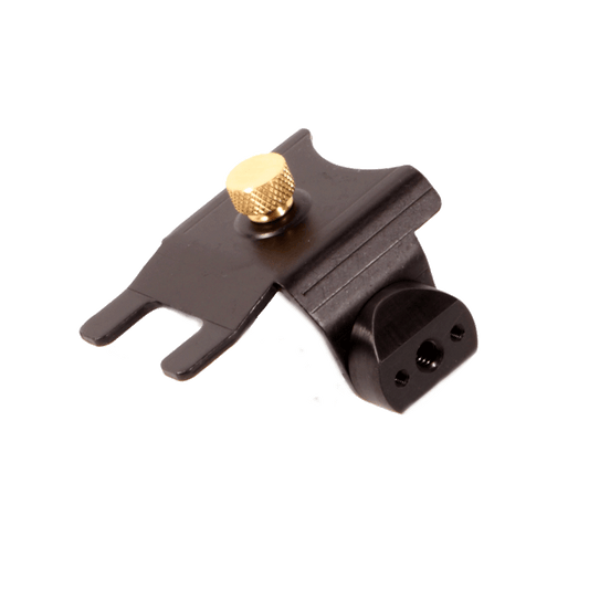
TP360 Mounting Bracket for Surveying Prisms
Mounting Bracket for TruPulse 360 and 200. Provides central pivot point when used with part number 7024746 (“L” bracket) and mounted to a monopod or tripod. -
Sold outRegular price $0.00Regular priceUnit price per
Trimble MX7 Mobile Imaging System
The Trimble MX7 mobile imaging system is a vehicle-mounted photogrammetric system that makes it easy to quickly and completely capture road and site infrastructure information. The Trimble MX7 Mobile Imaging System is a fast and cost effective way to manage assets such as bridges, buildings, roads, highways, and power stations, and document site conditions with geo-referenced images. Capture 360 degree, 30 megapixel geo-referenced images at highway speeds to rapidly reduce project field time. ONLY AVAILABLE FOR DELIVERY IN TEXAS, OKLAHOMA, AND ARIZONA. CONTACT SALESPERSON HERESold out -
Regular price $1,085.00Regular priceUnit price per
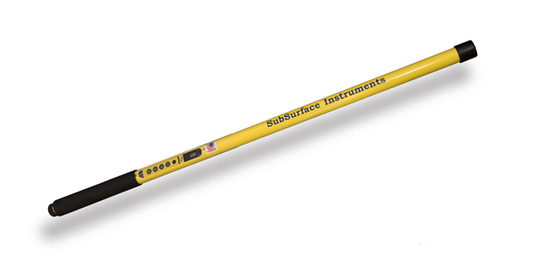
SSI ML-3S Short Magnetic Locator
The ML-3 is a much-anticipated and welcome addition to the ML family of magnetic locators from SSI. ML-3 magnetic locators represent the best in innovation at work for the water/sewer industry, surveying industry and military. That's because the ML-3 reflects many of the items on our customers' technological wish lists. The ML-3 short is 40" to meet surveyors' personal preference, providing an ergonomic, lightweight, rugged, one-handed operation option to traditional magnetic locators. The ML-3 offers unparalleled durability, as all components are housed inside the aircraft-grade aluminum monotube units. Photo of ML-3S - 100% waterproof. -
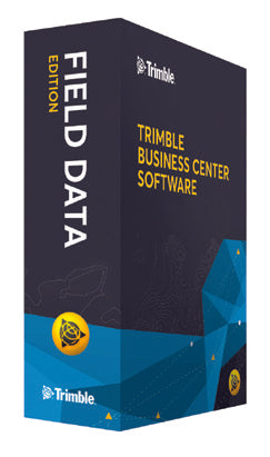
TBC Field Data features Coordinate System Management, Data Viewing, Feature Definition Management, GNSS Online Planning, Sketchup Compatibility, Trimble Field data Import and Export, Trimble Synch Manager and VisionLink. Also features Basic CAD _ COGO Tools, Data Spreadsheets, Feature Code Processing, Import + Adjust Level Data, Locate Site Setting, Optical Data Processing and Third Party Data Export. ONLY AVAILABLE FOR DELIVERY IN TEXAS, OKLAHOMA AND ARIZONA.
-
Regular price $492.90Regular priceUnit price per
Target ID Module with mini rod
Target ID Module with mini rod. Pair either the VX & S-Series 360 prism or the R10 360 Prism with the Target ID module to ensure you find and measure the correct target using Trimble Active Tracking technology. -
Regular price $2,883.20Regular priceUnit price per
Small Monitoring PrismS - 25mm Prism (Box of 25)
Small Monitoring Prism 25mm Prism (Box of 25). Can be mounted horizontally or vertically. Prism Constant: -17mm. -
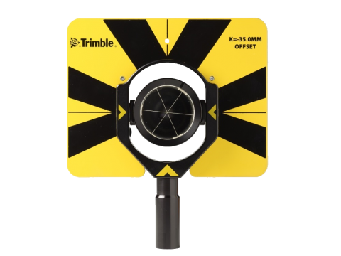
Regular price $795.00Regular priceUnit price per
Traverse Prism w/ Sight Target
Traverse prism with sighting target and AR coating. Target height - Trimble Standard - 135mm. Prism Constant: -35mm -
Sold outRegular price $551.20Regular priceUnit price per
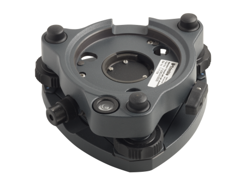
Tribrach with Optical Plummet
Trimble Tribrach with optical plummet for prisms, targets or GNSS setups. Tribrach 3 Pin type (GDM/GTR/ATS).Sold out -
Regular price $29.54Regular priceUnit price per
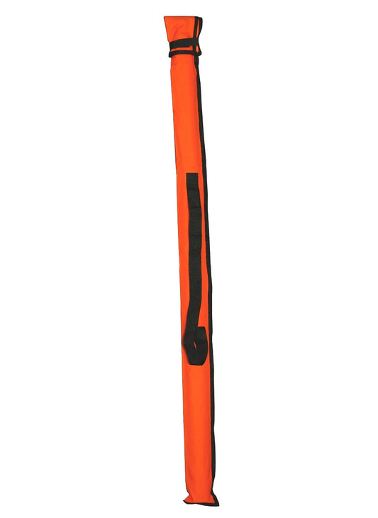
SECO Crain USL / SVR 13' Carrying Case
Crain USL/SVR 13' Carrying Case. Made from the highest quality 1000-denier nylon and is water resistant. For 13', 16', 20' and 25' CR Series Measuring Rod. Measures 4.25 x 65.5 in (10.8 x 166.4 cm). -
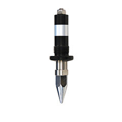
Replacement tip for Trimble Carbon Fiber Monopole (PN 88142-01).Sold out
-
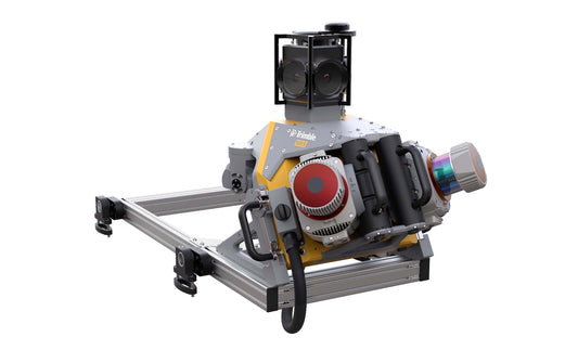
The MX9 AP60 Dual Head is a complete field-to-finish mobile mapping solution and uses the highest grade commercial IMU on the market. This system comes with the AP60 Trimble IMU with GNSS antenna, Dual Laser configuration lidar sensors, 360 Spherical camera, Dual Forward facing oblique cameras and a single Backward down facing Oblique camera. Additional Options for this system include GAMS and DMI. The MX9 is a complete field-to-finish mobile mapping solution combining state-of-the-art, advanced hardware with intuitive field software and a reliable, efficient office software workflow. The MX9 mounts on top of a vehicle and rapidly captures dense point clouds and images—both panoramic and multi-angle. Rich corridor data can be collected at highway speeds, significantly improving data collection on busy highways and avoiding costly lane closures. It is the next-generation solution for your needs today. For more information, see www.allterracentral.com/mx9. ONLY AVAILABLE FOR DELIVERY IN TEXAS, OKLAHOMA, AND ARIZONA. CONTACT SALESPERSON HERESold out