877.309.4099
 Contact Sales
 877.309.4099
 Contact Sales
-
Regular price $26,900.00Regular priceUnit price per
Trimble RealWorks Advanced Plant
Trimble's complete solutions for applying laser scanning technology to perform precise, accurate, storage tank inspections and calibrations save money, increase field worker safety, and produce superior results over other spatial measurement methods. ONLY AVAILABLE FOR OUR CUSTOMERS IN TEXAS, OKLAHOMA AND ARIZONA -
Regular price $18,990.00Regular priceUnit price per
Trimble RealWorks Advanced Modeler
The Trimble RealWorks Modeler module, which is an optional addition to the Advanced version, provides a fast and intuitive 3D modeling capability. It is particularly suited to civil engineering surveys and applications such as site refurbishments where modeled and textured structures enhance or complete the impact and scope of a surveyors' or engineers' final deliverable. ONLY AVAILABLE FOR OUR CUSTOMERS IN TEXAS, OKLAHOMA AND ARIZONA -
Regular price $11,425.00Regular priceUnit price per
Trimble RealWorks Advanced
With Trimble RealWorks Advanced, users can leverage the powerful 2D/3D inspection tools as well as cross-section, ortho-projection and profiling features to produce compelling civil survey deliverables. Trimble 3D scanning software allows you to integrate 3D point and survey data to Extract measurements, Generate deliverables and Utilize inside 3D CAD software. Trimble RealWorks is specifically designed for point cloud processing and analysis. The software provides a complete solution to efficiently register, analyze, model and create deliverables using data from virtually any source. ONLY AVAILABLE FOR OUR CUSTOMERS IN TEXAS, OKLAHOMA AND ARIZONA -
Regular price $5,170.00Regular priceUnit price per
Trimble RealWorks Software
Trimble 3D scanning software allows you to integrate 3D point and survey data to Extract measurements, Generate deliverables and Utilize inside 3D CAD software. Trimble RealWorks is specifically designed for point cloud processing and analysis. The software provides a complete solution to efficiently register, analyze, model and create deliverables using data from virtually any source. ONLY AVAILABLE FOR OUR CUSTOMERS IN TEXAS, OKLAHOMA AND ARIZONA -
Sold outRegular price $6,780.00Regular priceUnit price per
Trimble Business Center Complete Network License
Designed for advanced surveying workflow offering corridor design capabilities for road construction process. The Advanced edition offers effective tools for your most advanced CAD designs as well as features that enable users to perform photogrammetric measurements from Trimble Vision instruments including the Trimble V10 Imaging Rover. ONLY AVAILABLE FOR DELIVERY IN TEXAS, OKLAHOMA AND ARIZONA.Sold out -
Sold outRegular price $4,615.00Regular priceUnit price per
Trimble Business Center TBC Intermediate Survey License
The Trimble Business Center (TBC) - Intermediate Edition offers full GNSS data processing from GPS, GLONASS, BeiDou, Galileo and QZSS systems. ONLY AVAILABLE FOR DELIVERY IN TEXAS, OKLAHOMA AND ARIZONA.Sold out -
Use Job files and planning files directly from GPSeismic and easily export postplot details into GPSeismic.
-
You can generate reports for your surveyed mine while in the field. Use these reports to check data in the field, or to transfer data from the field to your client. ONLY AVAILABLE FOR OUR CUSTOMERS IN TEXAS, OKLAHOMA AND ARIZONA This is a downloadable product and No Media will be shipped. (An AllTerra Central Salesperson will contact after purchase and provide an installation code.)
-
Regular price $2,155.00Regular priceUnit price per
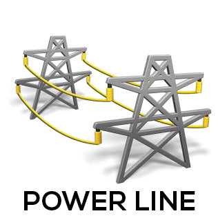
Trimble PowerLines Software
Review auto scanned and manually measured points and review set out points. You can generate reports for your surveyed tunnel while in the field. Use these reports to check data in the field, or to transfer data from the field to your client or to the office for further processing with office software. ONLY AVAILABLE FOR OUR CUSTOMERS IN TEXAS, OKLAHOMA AND ARIZONA This is a downloadable product and No Media will be shipped. (An AllTerra Central Salesperson will contact after purchase and provide an installation code.) -
The Trimble® Power Line application provides a streamlined workflow to measure and estimate the sag of a power line without shooting the cable. It provides a conventional survey workflow to record points on both power pole and line. The wizard-based workflow in the Power Line software helps you define key points on the power pole. Key points are trigger points that can be used to, for example, automatically create a virtual plane between points on two power poles or launch a co-ordinate geometry calculation. ONLY AVAILABLE FOR OUR CUSTOMERS IN TEXAS, OKLAHOMA AND ARIZONA This is a downloadable product and No Media will be shipped. (An AllTerra Central Salesperson will contact after purchase and provide an installation code.)
-
Record the tally, Map the joints, Merge tally and join mapping, Survey the Pipeline, Pipeline COGO, and use for reporting. ONLY AVAILABLE FOR OUR CUSTOMERS IN TEXAS, OKLAHOMA AND ARIZONA This is a downloadable product and No Media will be shipped. (An AllTerra Central Salesperson will contact after purchase and provide an installation code.)
-
Define, Survey, and Report your road. The streamlined workflow for Trimble® Access™ Roads adds powerful tools to simplify road stakeout. The step-by-step approach guides you with minimal training, providing all the tools at your fingertips to complete a road stakeout project. All the other non-road stakeout functionality is also easily accessible from General Survey—if you need it. Key Features:- Streamlined workflow- The most powerful road stakeout software on the market - Customizable staked delta reporting - Fully customizable outputs and reports ONLY AVAILABLE FOR OUR CUSTOMERS IN TEXAS, OKLAHOMA AND ARIZONA This is a downloadable product and No Media will be shipped. (An AllTerra Central Salesperson will contact after purchase and provide an installation code.)

Item added to your cart