877.309.4099
 Contact Sales
 877.309.4099
 Contact Sales
-
Regular price $695.00Regular priceUnit price per
Trimble TerraFlex Premium Subscription
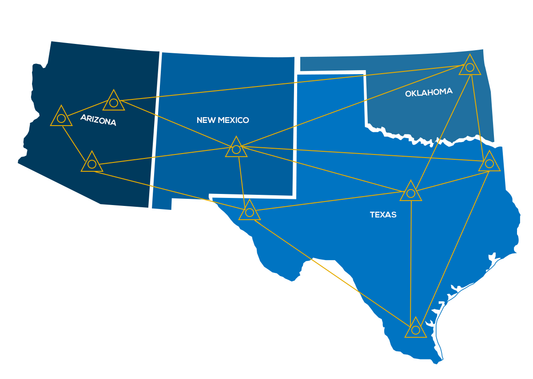
Unify all of your data collection and update activities with a single system for everyday geospatial field work. Use TerraFlex to collect or update any kind of data in the field with simple forms that you create. Whether your day includes capturing GIS data, incident reports, emergency management or simple inspections, you can use the same streamlined approach to collect geolocated information. Now you can keep field users focused on getting the job done fast. Keep your whole team in sync. No matter how big or small your project, you can review the data as it is collected in the field. ONLY AVAILABLE FOR OUR CUSTOMERS IN TEXAS, NEW MEXICO, OKLAHOMA AND ARIZONA This is a downloadable product and No Media will be shipped. (An AllTerra Central Salesperson will contact after purchase and provide an installation code.) -
This is a 1 year subscription to AllTerra Central’s RTK Network. Valid only in AZ/OK/NM/AZ ONLY. Following purchase, a staff member from AllTerra Central will reach out to you with your network login information.
-
-
LP360 Drone - UAV LiDAR and photogrammetry data processingProcess, analyze, and maximize drone survey data, producing valuable information and deliverables Drone LiDAR and photo processing workflow made simple Intuitive workflow Multi-flight import and processing GIS interface allowing combination with other geospatial data Powerful point cloud visualization with multiple and synchronized windows ONLY AVAILABLE FOR DELIVERY IN TEXAS, OKLAHOMA, NEW MEXICO AND ARIZONA. CONTACT SALESPERSON HEREQuote Now
-
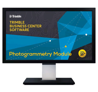
Manage aerial survey and mapping projects from fly to finish. The Trimble® Business Center (TBC) aerial photogrammetry solution brings advanced aerial photogrammetry workflow capabilities together with existing survey workflow and data processing features. Process + create deliverables with Trimble + third-party UAS data in TBC + UASMaster. Note: Each Trimble® Business Center (TBC) Module is designed to support a group of workflows around a single topic. Modules are add-ons to an edition of Trimble Business Center. ONLY AVAILABLE FOR OUR CUSTOMERS IN TEXAS, OKLAHOMA AND ARIZONA Trimble Business Center Aerial Survey - Perpetual License. This is a downloadable product and No Media will be shipped. (An AllTerra Central Salesperson will contact after purchase and provide an installation code.)Quote NowSold out
-
Manage aerial survey and mapping projects from fly to finish. The Trimble® Business Center (TBC) aerial photogrammetry solution brings advanced aerial photogrammetry workflow capabilities together with existing survey workflow and data processing features. Process + create deliverables with Trimble + third-party UAS data in TBC + UASMaster. Note: Each Trimble® Business Center (TBC) Module is designed to support a group of workflows around a single topic. Modules are add-ons to an edition of Trimble Business Center. ONLY AVAILABLE FOR OUR CUSTOMERS IN TEXAS, OKLAHOMA AND ARIZONA Trimble Business Center Aerial Survey - Annually, Per Seat. This is a downloadable product and No Media will be shipped. (An AllTerra Central Salesperson will contact after purchase and provide an installation code.)Quote Now
-
Regular price $90.00Regular priceUnit price per
Trimble TerraFlex Premium Monthly Subscription
Unify all of your data collection and update activities with a single system for everyday geospatial field work. Use TerraFlex to collect or update any kind of data in the field with simple forms that you create. Whether your day includes capturing GIS data, incident reports, emergency management or simple inspections, you can use the same streamlined approach to collect geolocated information. Now you can keep field users focused on getting the job done fast. Keep your whole team in sync. No matter how big or small your project, you can review the data as it is collected in the field. ONLY AVAILABLE FOR OUR CUSTOMERS IN TEXAS, NEW MEXICO, OKLAHOMA AND ARIZONA This is a downloadable product and No Media will be shipped. (An AllTerra Central Salesperson will contact after purchase and provide an installation code.) -
Regular price $495.00Regular priceUnit price per
Trimble TerraFlex Standard Subscription
Unify all of your data collection and update activities with a single system for everyday geospatial field work. Use TerraFlex to collect or update any kind of data in the field with simple forms that you create. Whether your day includes capturing GIS data, incident reports, emergency management or simple inspections, you can use the same streamlined approach to collect geolocated information. Now you can keep field users focused on getting the job done fast. Keep your whole team in sync. No matter how big or small your project, you can review the data as it is collected in the field. ONLY AVAILABLE FOR OUR CUSTOMERS IN TEXAS, NEW MEXICO, OKLAHOMA AND ARIZONA This is a downloadable product and No Media will be shipped. (An AllTerra Central Salesperson will contact after purchase and provide an installation code.) -
Regular price $65.00Regular priceUnit price per
Trimble TerraFlex Standard Subscription - Monthly
Unify all of your data collection and update activities with a single system for everyday geospatial field work. Use TerraFlex to collect or update any kind of data in the field with simple forms that you create. Whether your day includes capturing GIS data, incident reports, emergency management or simple inspections, you can use the same streamlined approach to collect geolocated information. Now you can keep field users focused on getting the job done fast. Keep your whole team in sync. No matter how big or small your project, you can review the data as it is collected in the field. ONLY AVAILABLE FOR OUR CUSTOMERS IN TEXAS, NEW MEXICO, OKLAHOMA AND ARIZONA This is a downloadable product and No Media will be shipped. (An AllTerra Central Salesperson will contact after purchase and provide an installation code.) -
Regular price $330.00Regular priceUnit price per
Trimble TerraFlex Basic Annual Subscription
Use TerraFlex to collect or update any kind of data in the field with simple forms that you create. Whether your day includes capturing GIS data, incident reports, emergency management or simple inspections, you can use the same streamlined approach to collect geolocated information. Now you can keep field users focused on getting the job done fast. Keep your whole team in sync. No matter how big or small your project, you can review the data as it is collected in the field. ONLY AVAILABLE FOR OUR CUSTOMERS IN TEXAS, NEW MEXICO, OKLAHOMA AND ARIZONA This is a downloadable product and No Media will be shipped. (An AllTerra Central Salesperson will contact after purchase and provide an installation code.) -
Regular price $45.00Regular priceUnit price per
Trimble TerraFlex Starter Subscription - Monthly
Use TerraFlex to collect or update any kind of data in the field with simple forms that you create. Whether your day includes capturing GIS data, incident reports, emergency management or simple inspections, you can use the same streamlined approach to collect geolocated information. Now you can keep field users focused on getting the job done fast. Keep your whole team in sync. No matter how big or small your project, you can review the data as it is collected in the field. ONLY AVAILABLE FOR OUR CUSTOMERS IN TEXAS, NEW MEXICO, OKLAHOMA AND ARIZONA This is a downloadable product and No Media will be shipped. (An AllTerra Central Salesperson will contact after purchase and provide an installation code.) -
Regular price $9,880.00Regular priceUnit price per
Trimble Business Center Site Modeling
Trimble Business Center is the complete survey and construction office software enabling field to finish workflows with confidence. In a single software package, combine raw measurements from GNSS, total stations, and levels; then, add in data from unmanned aerial vehicles (UAVs), mobile mapping systems, and terrestrial laser scanners, all of which is scaled to your survey data. Create rich deliverables with point, adjustment, takeoff, and many other report types, digital surface and site models, CAD plans, point clouds, corridor designs, machine control models, and station-based imagery. Or work with other industry-leading soft- ware packages from Autodesk®, Bentley®, ESRI, and others. When it’s time to submit, store and share projects online to Trimble Connect, Trimble Sync ManagerTM, Trimble Clarity, or Bentley ProjectWise®, all initiated with TBC. TBC - Field to Finish with Confidence. ONLY AVAILABLE FOR DELIVERY IN TEXAS, OKLAHOMA AND ARIZONA. -
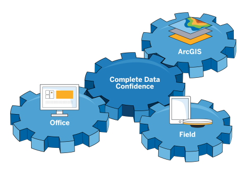
Trimble Terra Office Standard is the smart way to ensure your GIS is populated with field data you can trust with deep integration with GIS systems-of-record. Trimble Terra Office is a new subscription-based desktop software for Esri® ArcGIS® users, Trimble® Terra™ Office add-in for ArcMap®. Terra Office supports Trimble TerraFlex™ offline GNSS corrections in addition to all workflows supported by the Trimble Positions™ Desktop add-in. Trimble Terra Office replaces both Trimble Positions Desktop and Trimble TerraFlex Desktop add-ins. Trimble Terra Office replaces Trimble Positions. 12 month standard Subscription-based Desktop Software. ONLY AVAILABLE FOR OUR CUSTOMERS IN TEXAS, NEW MEXICO, OKLAHOMA AND ARIZONA This is a downloadable product and No Media will be shipped. (An AllTerra Central Salesperson will contact after purchase and provide an installation code.)Sold out
-
Regular price $500.00Regular priceUnit price per
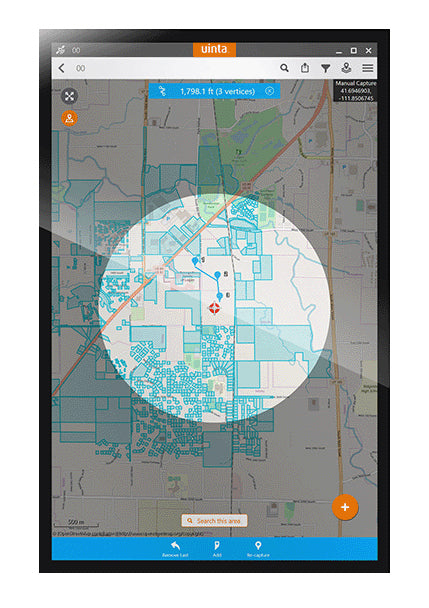
Juniper Systems Uinta Mapping Software
Tired of complex and expensive GIS mapping software with limited abilities to customize for your job? We were too. Train new users in minutes with Uinta mapping and form data collection software. Available for Windows™ and Android™. TOP FEATURES: Efficient Data Capture: Replace paper forms with efficient electronic data entry forms, for use with or without maps Professional Mapping: Quickly map points, lines, and areas. High-accuracy mapping supported Customizable: Create custom project templates so field-collected data reflects your job(s) User-friendly: Simple interface allows users to be trained and collecting data in minutes Sharable: Export data to a file, print professional PDF map reports, and create optional cloud projects Free & Live Support: Get a jump start on your project with help from Juniper Systems' in-house customer success team This is a downloadable product and No Media will be shipped. (An AllTerra Central Salesperson will contact after purchase and provide an installation code.) -
Regular price $667.80Regular priceUnit price per
Trimble TerraFlex Basic Subscription
Powerful app for field survey and high accuracy GIS data collection The Trimble® Penmap for Android mobile application is a powerful, yet incredibly straightforward, cloud-connected application for cadastral field surveying and high-accuracy GIS data collection. Penmap is designed to provide both professional surveyors and field workers with a reliable and complete data collection application. Easy to use Easy-to-use, interactive, and map-based user interface - enabling a broader set of the community to aid in data collection GIS • Support of spatial and non-spatial features • Land Administration Domain Model (LADM) and Social Tenure Domain Model (STDM) compliance -adhering to international Fit-For-Purpose Land Administration standards • Streamlined forms to collect tenure data e.g. person, parties, signatures, pictures etc. Expires 12 months from invoice date. ONLY AVAILABLE FOR OUR CUSTOMERS IN TEXAS, NEW MEXICO, OKLAHOMA AND ARIZONA This is a downloadable product and No Media will be shipped. (An AllTerra Central Salesperson will contact after purchase and provide an installation code.) -
Regular price $30,870.00Regular priceUnit price per
Trimble eCognition Software
Trimble eCognition enables you to accelerate and automate the interpretation of your geospatial data products by allowing you to design your own feature extraction and change detection solutions. With more than 20 years of feature extraction experience, Trimble have pioneered object-based analysis techniques and continue to push the envelope of data fusion and integrated analyses. Watch eCognition TV to learn more here. ONLY AVAILABLE FOR OUR CUSTOMERS IN TEXAS, NEW MEXICO, OKLAHOMA AND ARIZONA This is a downloadable product and No Media will be shipped. (An AllTerra Central Salesperson will contact after purchase and provide an installation code.) -
Sold outRegular price $2,200.00Regular priceUnit price per
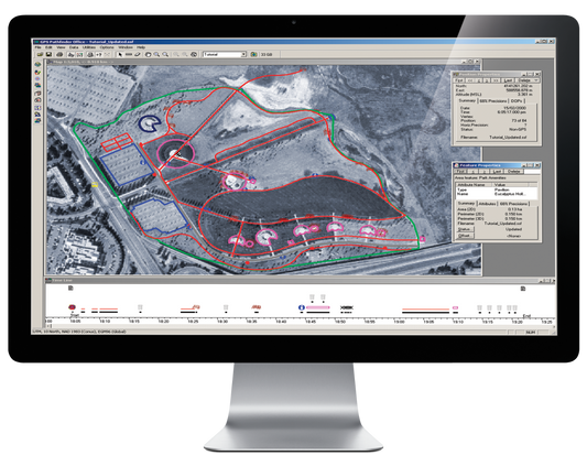
Trimble Pathfinder Office
Trimble Pathfinder Office software for easy processing and exporting of your Trimble MGIS data to your GIS or CAD system. ONLY AVAILABLE FOR OUR CUSTOMERS IN TEXAS, NEW MEXICO, OKLAHOMA AND ARIZONA This is a downloadable product and No Media will be shipped. (An AllTerra Central Salesperson will contact after purchase and provide an installation code.)Sold out -
Easy to use field data collection software for anyone needing to quickly and accurately map, measure or position anything. This is a downloadable product and No Media will be shipped. (An AllTerra Central Salesperson will contact after purchase and provide an installation code.)
-
Sold outRegular price $3,816.00Regular priceUnit price per
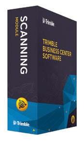
Trimble Business Center Scanning Module
Add the Trimble Business Center Scanning (TBC) Module to your existing Complete/Advanced Network License. With the new Scanning Module users can easily integrate rich point cloud and image data from the new Trimble SX10 Scanning Total Station and other industry-standard point cloud formats within familiar workflow processes. This optional module includes powerful tools to efficiently manage, view and extract quality information from point cloud data, enabling professionals to rapidly generate client deliverables with confidence. (Requires HASP key ID; Match # of seats) ONLY AVAILABLE FOR OUR CUSTOMERS IN TEXAS, OKLAHOMA AND ARIZONA This is a downloadable product and No Media will be shipped. (An AllTerra Central Salesperson will contact after purchase and provide an installation code.)Sold out

Item added to your cart