 877.309.4099
 Contact Sales
 877.309.4099
 Contact Sales


All
Sodex SDX-PocketScan: Handheld Scan Surveying for iPhone Pro
Sodex SDX-PocketScan: Handheld Scan Surveying for iPhone Pro
In stock
Share this product


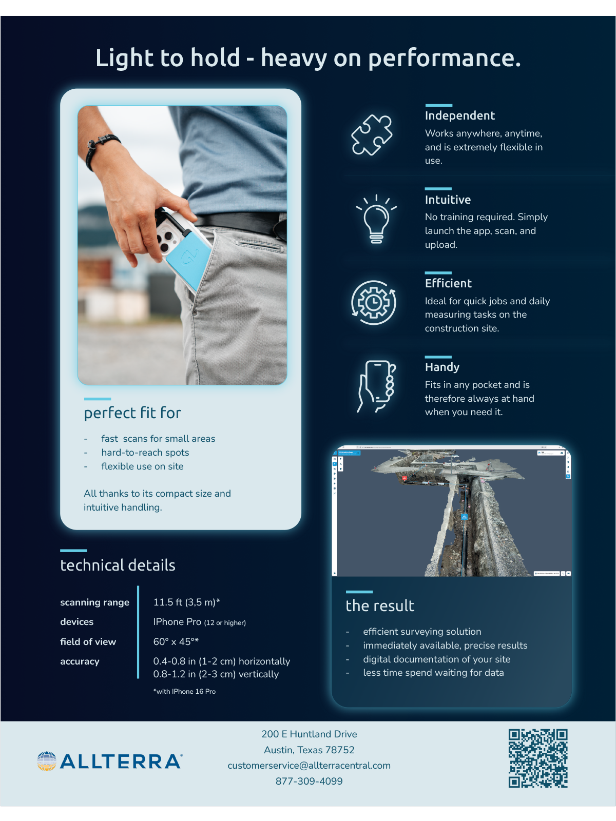
The Sodex SDX PocketScan brings fast, reliable as-built documentation to any job site. Its compact, pocket-sized design enables any field crew member to capture high‑quality 3D models for job proof, reporting, and full traceability, and all with minimal training. From daily reporting to utility installation mapping, the Sodex SDX PocketScan delivers professional results without requiring specialized surveying expertise.
Designed for versatile, high‑accuracy field documentation, the Sodex SDX‑PocketScan supports both LiDAR and photogrammetry capture modes, making it suitable for a wide range of applications. Its reliable data output enhances quality assurance and inspection workflows, ensuring accurate, repeatable results and enabling better decision‑making throughout the project lifecycle.
Data captured with Sodex SDX‑PocketScan is instantly processed in SDX-Cloud within minutes. There is no user post‑processing needed, enabling teams to review cross-sections, conduct measurements, and report job completion almost in real time.
Benefit from the Sodex solution ecosystem, as SDX‑Cloud not only automatically integrates data generated by Sodex solutions, but also allows users to upload drone, total station, scanner, and machine control data, covering all surveying needs in one platform.
Ideal For: Underground utility construction, small site surveying, earthworks, and landscapes
- Field of View: 60° x 45°
- Scanning Range: Up to 11.5 ft (3.5 m)
- Accuracy: RTK: 0.4-0.8 in (1-2 cm) horizontally, 0.8-1.2 in (2-3 cm) vertically
- Devices: Compatible with iPhone Pro (12 or higher)
Only available in Texas


