877.309.4099
 Contact Sales
 877.309.4099
 Contact Sales





All
Trimble Access Software Modules
Trimble Access Software Modules
Out of stock
Use Job files and planning files directly from GPSeismic and easily export postplot details into GPSeismic.

Share this product



Land Seismic
The Trimble Land Seismic application includes powerful tools to simplify stakeout operations associated with land seismic surveys.
Grid-Based Navigation
- Use grid files directly from Trimble GPSeismic planning software.
- Simple navigation to the stake location using inline and crossline deltas.
- Perform offsetting in the field without any calculations.
Exclusion Zone Monitoring
- Import exclusion zones directly from GPSeismic.
- Points cannot be accidentally staked in an exclusion zone.
- Point buffer circles.
Mines
The Trimble Mines application includes powerful tools to survey and report on mine operations. The easy to use interface guides you through tasks such as auto staking lines to position a drilling rig within a mine using a Trimble S Series total station.
Survey
- Define and auto stake center, grade, and laser lines to align a drilling rig.
- Auto stake pre-defined blast hole positions.
- Auto stake predefined pivot points to position a drilling rig.
Reports
You can generate reports for your surveyed mine while in the field. Use these reports to check data in the field, or to transfer data from the field to your client.
PowerLines
The Trimble Power Line application provides a streamlined workflow to measure and estimate the sag of a power line without shooting the cable. It provides a conventional survey workflow to record points on both power pole and line.
The wizard-based workflow in the Power Line software helps you define key points on the power pole. Key points are trigger points that can be used to, for example, automatically create a virtual plane between points on two power poles or launch a co-ordinate geometry calculation.
The workflow guides the user through the following steps:
- Defining key elements on the pole
- Creating a virtual lines
- Staking out line elements and adjusting the height based on the sag
The application is built to deliver
- Fast
- Easy
- Reliable
- Reproducible
Transmission line sag measurement.
Supported devices:
-TSC3, TSC2, Trimble CU, Trimble M3, Trimble C5, Trimble Tablet, Trimble T10
Tunnels
The Trimble Tunnels application includes powerful tools to define, survey, stakeout, and report on tunnel operations. The easy to use interface guides you through tasks such as marking areas of underbreak and overbreak, and positioning machinery.
Define your Tunnel
- Refine tunnel components including horizontal and vertical alignments, templates, and rotation, or import a definition from a LandXML file.
- Define end-face blast holes and set-out positions typically used for bolt holes.
- Review the tunnel before going underground.
Survey
- Auto scan cross sections including options to manually measure and delete points.
- Measure positions relative to the tunnel definition.
- Set out pre-defined positions.
- Position machinery, typically a drilling rig, relative to the tunnel.
Output and Reports
- Review auto scanned and manually measured points.
- Review set out points.
You can generate reports for your surveyed tunnel while in the field. Use these reports to check data in the field, or to transfer data from the field to your client or to the office for further processing with office software.
PipeLines
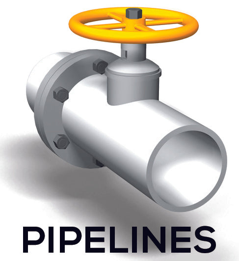
The Trimble® Pipelines application includes powerful tools to collect pipe attribute data, record the relationship between welds and pipes (joints), and then when the pipeline is surveyed, link the joint attributes to the measured welds. All data is recorded electronically, available for checking at every step in the process, and all recorded attributes are stored with the survey data.
Supported devices:
-TSC3, Trimble Tablet
Roads
The Trimble® Roads application includes powerful tools to define, survey, and report your road. The easy to use graphical interface simplifies road operations.
Supported devices:
- TSC3, TSC2, Trimble CU, Trimble Tablet, Slate GeoXR, Trimble S3, Trimble M3
Define Your Road
Upload a Trimble Road (RXL), or LandXML road definition, from Trimble Business Center software or third-party applications. You can also upload a Trimble Road via Trimble Link software from a number of third-party applications including; AutoCAD® LandDesktop, AutoCAD® Civil 3D®, Bentley® Inroads® and Bentley® GEOPAK®. Uploaded LandXML roads can be reviewed and edited and saved as a Trimble Road. Key in, from construction plans, or edit, a road definition including horizontal and vertical alignments, templates, superelevation and widening records and station equations. Alternatively define the horizontal alignment for the road from the map by selecting points, lines or arcs or by selecting line work in DXF, SHP or LandXML files. The graphical interface allows you to easily check
the road design before you start staking. And if you are using a supported Tablet, check your road in 3D including relative to secondary roads.
Stakeout Road
The powerful graphical selection screen provides an intuitive workflow. Construction offsets, slope staking, and real-time in-the-field redesign allow fast and easy stakeout with confidence. Precise elevation road stakeout allows you to perform dual measurements with a robotic total station and GNSS receiver at the same time using the GNSS receiver for easy horizontal control,
and the robotic instrument to improve the
vertical precision.
Land Seismic
The Trimble Land Seismic application includes powerful tools to simplify stakeout operations associated with land seismic surveys.
Grid-Based Navigation
- Use grid files directly from Trimble GPSeismic planning software.
- Simple navigation to the stake location using inline and crossline deltas.
- Perform offsetting in the field without any calculations.
Exclusion Zone Monitoring
- Import exclusion zones directly from GPSeismic.
- Points cannot be accidentally staked in an exclusion zone.
- Point buffer circles.
Mines
The Trimble Mines application includes powerful tools to survey and report on mine operations. The easy to use interface guides you through tasks such as auto staking lines to position a drilling rig within a mine using a Trimble S Series total station.
Survey
- Define and auto stake center, grade, and laser lines to align a drilling rig.
- Auto stake pre-defined blast hole positions.
- Auto stake predefined pivot points to position a drilling rig.
Reports
You can generate reports for your surveyed mine while in the field. Use these reports to check data in the field, or to transfer data from the field to your client.
PowerLines
The Trimble Power Line application provides a streamlined workflow to measure and estimate the sag of a power line without shooting the cable. It provides a conventional survey workflow to record points on both power pole and line.
The wizard-based workflow in the Power Line software helps you define key points on the power pole. Key points are trigger points that can be used to, for example, automatically create a virtual plane between points on two power poles or launch a co-ordinate geometry calculation.
The workflow guides the user through the following steps:
- Defining key elements on the pole
- Creating a virtual lines
- Staking out line elements and adjusting the height based on the sag
The application is built to deliver
- Fast
- Easy
- Reliable
- Reproducible
Transmission line sag measurement.
Supported devices:
-TSC3, TSC2, Trimble CU, Trimble M3, Trimble C5, Trimble Tablet, Trimble T10
Tunnels
The Trimble Tunnels application includes powerful tools to define, survey, stakeout, and report on tunnel operations. The easy to use interface guides you through tasks such as marking areas of underbreak and overbreak, and positioning machinery.
Define your Tunnel
- Refine tunnel components including horizontal and vertical alignments, templates, and rotation, or import a definition from a LandXML file.
- Define end-face blast holes and set-out positions typically used for bolt holes.
- Review the tunnel before going underground.
Survey
- Auto scan cross sections including options to manually measure and delete points.
- Measure positions relative to the tunnel definition.
- Set out pre-defined positions.
- Position machinery, typically a drilling rig, relative to the tunnel.
Output and Reports
- Review auto scanned and manually measured points.
- Review set out points.
You can generate reports for your surveyed tunnel while in the field. Use these reports to check data in the field, or to transfer data from the field to your client or to the office for further processing with office software.
PipeLines
The Trimble® Pipelines application includes powerful tools to collect pipe attribute data, record the relationship between welds and pipes (joints), and then when the pipeline is surveyed, link the joint attributes to the measured welds. All data is recorded electronically, available for checking at every step in the process, and all recorded attributes are stored with the survey data.
Supported devices:
-TSC3, Trimble Tablet
Roads
The Trimble® Roads application includes powerful tools to define, survey, and report your road. The easy to use graphical interface simplifies road operations.
Supported devices:
- TSC3, TSC2, Trimble CU, Trimble Tablet, Slate GeoXR, Trimble S3, Trimble M3
Define Your Road
Upload a Trimble Road (RXL), or LandXML road definition, from Trimble Business Center software or third-party applications. You can also upload a Trimble Road via Trimble Link software from a number of third-party applications including; AutoCAD® LandDesktop, AutoCAD® Civil 3D®, Bentley® Inroads® and Bentley® GEOPAK®. Uploaded LandXML roads can be reviewed and edited and saved as a Trimble Road. Key in, from construction plans, or edit, a road definition including horizontal and vertical alignments, templates, superelevation and widening records and station equations. Alternatively define the horizontal alignment for the road from the map by selecting points, lines or arcs or by selecting line work in DXF, SHP or LandXML files. The graphical interface allows you to easily check
the road design before you start staking. And if you are using a supported Tablet, check your road in 3D including relative to secondary roads.
Stakeout Road
The powerful graphical selection screen provides an intuitive workflow. Construction offsets, slope staking, and real-time in-the-field redesign allow fast and easy stakeout with confidence. Precise elevation road stakeout allows you to perform dual measurements with a robotic total station and GNSS receiver at the same time using the GNSS receiver for easy horizontal control,
and the robotic instrument to improve the
vertical precision.