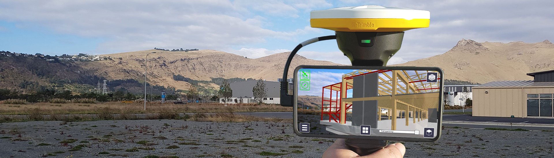
Trimble SiteVision
The power of information, reimagined
HARDWARE
High-accuracy positioning and measurement in a single package
- Integrated cm-accuracy GNSS with Trimble Catalyst
- Integrated Electronic Distance Measurement (EDM)
- Flexible design fits most phones (up to 8" screens)
- Waterproof and rugged
- Works hand-held or pole-mounted
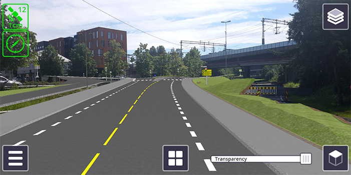
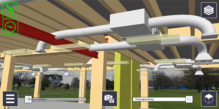
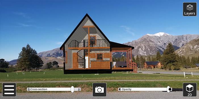
Visualize in 3D
Place and view georeferenced 3D models from any angle at true-to-life scale-above or below the ground
Collaborate
Share, communicate, and collectively interact in real time with easy-to-understand visualizations
Report
Take photos, measurements and notes in the field; create tasks and assign them to team members
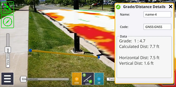
Measure
Measure positions using GNSS, Electronic Distance Measurement, and Augmented Reality to better understand your data on site
SOFTWARE
Easy-to-use software that brings your data to life
- Automatically place models on site with cm accuracy
- View fully textured, attribute rich, models in 3D
- Visualize models in context with transparency and sectioning
- View subsurface models with pit view
- Measure and report with ease
COMPATIBLE DEVICES
Trimble SiteVision runs on mobile devices, smaller than 8", supporting Google Play Services for AR and the Android™ Operating System Version 9.0.
Trimble Inc. has tested and verified Trimble SiteVision compatibility with the following Android mobile phones:
Note: Although Trimble Catalyst Service and Google Play Services for AR can run on a number of mobile devices, the requirements for SiteVision differ due to the combination of the processing requirements of Trimble Catalyst softGNSS Receiver, Google Play Services for AR, and data processing.
| Trimble tested and recommended devices for SiteVision |
|---|
| Samsung S9+ |
| Samsung S10+ |
| Samsung Note8 |
| Samsung Note9 |
| Other supported devices for SiteVision |
| Samsung S8+ |
| Google Pixel 2 XL |
| Google Pixel 3 XL |
APPLICATIONS
Trimble SiteVision is already at work in your industry
Client Engagement
Simplify explaining to clients by letting them see proposed designs, in situ using Augmented Reality. Allow the clients to walk around the proposed design and understand the details from different viewing angles in the context of the site. Share and discuss proposed design and design changes.
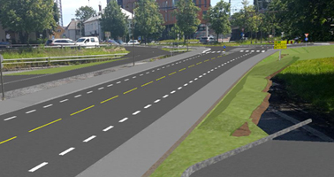
Planning
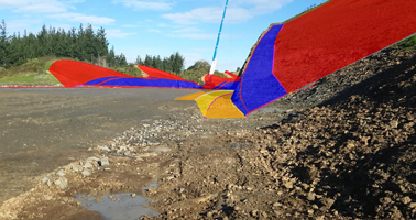
How will my planned road affect the surrounding environment? Use SiteVision to visualize design, the cut and fill values and how it will affect the surrounding environment.
Inspection
What is the progress of construction on site? Use SiteVision to visualize work planned, undertake inspections and work completed on a 'Stakeless Site'.
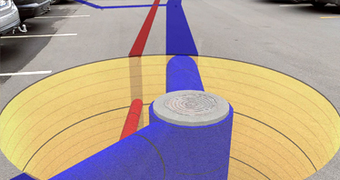
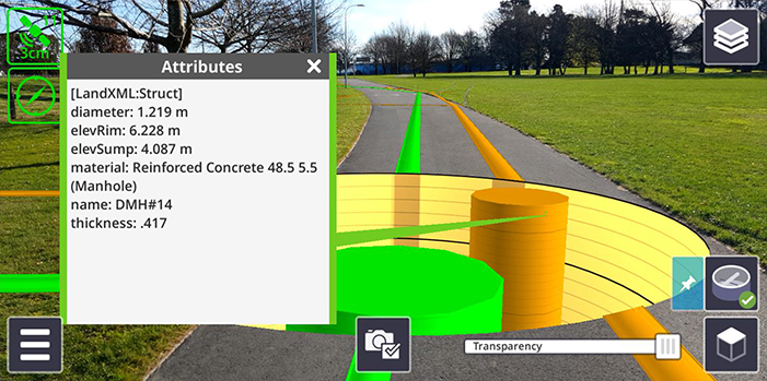
Subsurface Utilities
Where is the existing infrastructure that I can't see? Use SiteVision to utilize sub surface mapping information to visualize the location, size and attributes of underground infrastructure such as water, power, gas and telecommunications.
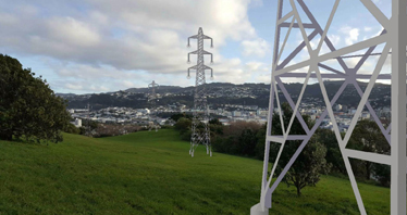
Electrical Utilities
View the visual impact of proposed designs. SiteVision allows you to provide better context on proposed changes during the public consultation phase, improving public understanding. Communicate with contractorsthe intended outcome and logistics associated with the construction phase.
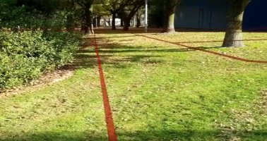
Cadastral Boundaries
How can I communicate land rights and restrictions? Use SiteVision as a tool to visualize cadastral boundaries, identify survey monuments, plan surveys and communicate complicated land rights and restrictions.
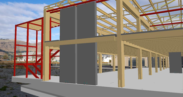
Structures
What will new construction look like against existing? Use SiteVision to visualize above ground structures and infrastructure such as intersections, bridges, tunnels and buildings.
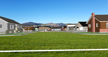
Real Estate Development
Communicate the design on site with city and regional authorities to speed up the planning approval. Show potential buyers what the future site will look like, as well as views from individual lots. Show proposed house designs on site.
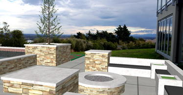
Landscape Architecture
How will my design fit the existing environment? Use SiteVision to visualize landscape designs and features in an existing environment.