Press Releases
AllTerra PR Release May 23, 2023
Trimble advances reality capture with the new X9 3D laser scanner
WESTMINSTER, Colo., May 23, 2023 /PRNewswire/ -- Trimble (NASDAQ: TRMB) announced today the Trimble® X9 3D laser scanning system, a new versatile reality capture solution for surveying, construction and engineering professionals. The X9 is built on Trimble's proven laser scanning technologies, engineered to enhance performance in more environments while leveraging innovations such as Trimble X-Drive technology for automatic instrument calibration, survey-grade self-leveling and laser pointer for georeferencing.

The new Trimble X9 expands on the industry-proven Trimble X7, delivering longer range, higher accuracy, shorter scan times and exceptional sensitivity, improving scan results and boosting productivity. Advanced processing and a high-performance laser increase the sensitivity of all scans, positioning the X9 at the forefront for capturing difficult dark or reflective surfaces. A new center unit design improves signal transmission for better scan quality. With more efficient reality capture capabilities, the X9 broadens potential applications for customers in surveying, building construction, oil and gas, rail, forensics, monitoring, tunneling, mining and others.
The X9 provides significant time savings with extremely accurate and dependable data, enabling confident decision making both in the field and in the office through in-field registration within Trimble Perspective and Trimble FieldLink by minimizing the need for target deployment. The auto-calibration eliminates the need for annual calibration, which lowers the cost of ownership, reduces downtime and significantly increases the users' return on investment. In addition, the X9 also includes survey-grade self-leveling with the industry's widest compensation range for fast, easy setup.
Trimble X9 data can be delivered directly from Trimble Perspective or FieldLink software to Trimble's office software, including Trimble Realworks™ 3D scanning software, Trimble Business Center office software, SketchUp and Tekla, or exported to industry-standard formats to produce application-specific deliverables. The Trimble ecosystem provides the software and flexibility to work the way scanning professionals want, so they can deliver what their customers need.
"Our customers buy Trimble because they want reliability and performance," said Jason Hayes, market manager, Reality Capture Solutions, Trimble Geospatial. "The Trimble X9 is simple to use, provides unsurpassed reliability, and excels at creating high-quality digital representations of the world for applications ranging from fast-paced building documentation to challenging outdoor surveys."
AllTerra PR Release March 15, 2023
AllTerra Grows Its UAV Portfolio by Becoming a GeoCue Distributer
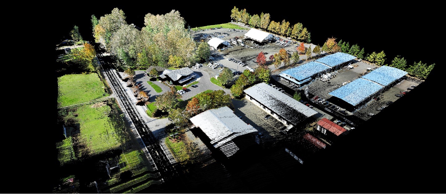
AllTerra Central, Inc., the world’s #1 Trimble geospatial dealer, has joined the distribution network of GeoCue. AllTerra will now provide the full line of TrueView 3D Imaging Sensors, an innovative UAV LiDAR and photogrammetry solution. It allows for fast, automated generation of true 3D colorized point clouds, oblique imagery, and orthophotos from a single UAV flight.
Geocue’s Kris Kelley had this to say about AllTerra:
“We couldn’t be happier having AllTerra Central as part of our Geocue team and we already know they will be successful. AllTerra has been supporting the Southwestern United States as a reputable Trimble dealer for decades. Having them sign on with Geocue to expand their menu and build up the marketplace with new payload options/geospatial software is a solid sign of faith in our company, as well as initiative for development and growth on both ends.”
AllTerra is also authorized to sell LP360 LiDAR & photogrammetry 3D point cloud software. LP360, an advanced desktop LIDAR software package, makes easy work of extracting information and generating deliverables in an intuitive GIS environment.
AllTerra Central is committed to providing geospatial solutions that fit all the needs of the modern surveyor. Part of that mission is being up to date on the latest technologies. In Geocue, AllTerra Central has a partner with a solid track record of providing reliable hardware and software for UAV LiDAR and imagery.
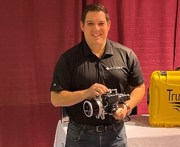
Chris Mauldin, AllTerra’s Technology Sales Manager
AllTerra’s Technology Sales Manager, Chris Mauldin said, “We are excited to add GeoCue to our geospatial portfolio. AllTerra Central prides itself on our ability to, not only offer the greatest in technology products, but to support them as well. We believe that by staying on top of technology products, we can help our customers become more efficient and grow their business.”
If you’re interested in UAV LiDAR, photogrammetry, and/or geospatial data processing software, please follow this link for more information.
![]()
AllTerra PR Release February 3, 2023

AllTerra RTKnet is now available in Arizona!
Austin, TX., Feb. 3, 2023 - AllTerra Central announces the launch of the Arizona portion of our 4 state VRS network. Network-wide access now includes Texas, Oklahoma, New Mexico and Arizona. You get 4 states with just 1 subscription to the AllTerra RTKnet.
“We have hundreds of receivers that make up our network across the 4 states," said Bobby Hempfling, President of AllTerra Central. “The AZ network will continue to improve, currently there is a VRS island for Phoenix as well as 10 additional Single Base solutions around the state. Our expansion into Arizona includes coverage of major metro areas and most populated areas.”
For more information, visit https://allterracentral.com/rtknet
About AllTerra Central, Inc.
AllTerra Central has offices throughout Texas, Oklahoma, New Mexico, and Arizona. AllTerra Central offers Trimble and Spectra Precision solutions in Surveying, MGIS, Marine, Forensics, Mobile Mapping and Infrastructure and provide sales, rentals, repairs, and support for these products. Additionally, they offer mobile/airborne LIDAR and Photogrammetry solutions from GeoCue and Microdrones.
AllTerra PR Release January 7, 2022

AllTerra Central / Frontier Precision announce acquisition of assets and business of BuildingPoint West
Austin, TX., Jan. 7, 2022 - AllTerra Central and Frontier Precision are excited to announce the acquisition of the assets of BuildingPoint West, based out of Golden, Colorado. BuildingPoint West served: Arizona, Colorado, Idaho, Montana, New Mexico, Nevada, Oklahoma, Texas, Utah, and Wyoming. AllTerra Central will be taking over the states of Arizona, New Mexico, Texas, and Oklahoma, while Frontier Precision will take over the states of Colorado, Wyoming, Montana, and Idaho and in the future – Utah and Nevada.
“We look forward to serving the construction professionals in the Rocky Mountains,” said Dennis Kemmesat, President and CEO of Frontier Precision. “BuildingPoint West has years of building construction and technology experience, we want to build on that longstanding service BuildingPoint West has provided to the region, with expanded portfolios of new products and services along with a more accessible local presence for service, repair, and technical support – we are certainly excited to now to have the full portfolio of Trimble Building Construction products to offer our customers in this region.”
Frontier Precision will be bringing the portfolio of products from Trimble to the region, along with new training, professional service, and support products to ensure customers get optimum value and return from their equipment purchases.
“We have long had an interest in more fully entering the vertical construction market” said Bobby Hempfling, President of AllTerra Central and now BuildingPoint Central. “We look forward to combining the layout expertise of AllTerra, the domain knowledge of BuildingPoint and the service/tech support infrastructure to better support our general contractors and MEP trade partners. With 6 service centers and tech support teams in all the major markets around Texas, Oklahoma, New Mexico, and Arizona, we can fully support our customers and bring a more robust solution to our customers.”
“We are very excited to join AllTerra Central and expand our contractor offerings with local support and service throughout our coverage area,” said Jim McCartney, BuildingPoint West Sales Manager. “This combination of workflow expertise and business infrastructure means an even better user experience for our valued client base.”
About AllTerra Central, Inc.
AllTerra Central Inc. was formed in 2018 by the merger of Western Data Systems (WDS) and Martin Instrument, two Trimble dealers in Texas and Oklahoma. The Trimble MGIS territory of New Mexico was added in 2019 with the purchase of assets from Compass Tools. In December of 2021, AllTerra Central purchased Allen Instruments’ Arizona location. AllTerra Central now has offices throughout Texas, Oklahoma, New Mexico, and Arizona. AllTerra Central offers Trimble and Spectra Precision solutions in Surveying, MGIS, Marine, Mobile Mapping and Infrastructure and provide sales, rentals, repairs, and support for these products. Additionally, they offer mobile/airborne LIDAR and Photogrammetry solutions from GeoSLAM and Microdrones.
About Frontier Precision
Frontier Precision is an employee-owned company with over 34 years of experience serving survey, mapping, engineering, construction, GIS, drones/UAS/unmanned, forensics, forestry, water resources, mosquito and vector control, invasive plant control, and natural resources professionals throughout the western United States.
From our original office in Bismarck, North Dakota, we’ve grown our footprint thousands of miles in every direction. Today, you’ll find us in South Dakota, Minnesota, Colorado, Alaska, Montana, Idaho, Hawaii, Oregon, and Washington. Additionally, Frontier provides service in the states of Wyoming, Utah, Florida, and Texas. We pride ourselves on offering exemplary customer service; and our industry professionals are here to help you find a solution to fit your needs.
AllTerra PR Release November 3, 2021
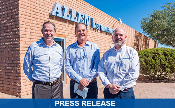
AllTerra Central and CSDS announce the acquisition of Allen Instruments & Supplies
Austin, TX., Nov. 3, 2021 - AllTerra Central and California Surveying & Drafting Supply, Inc. (CSDS), two leading Trimble Geospatial dealers globally, announce the purchase of Allen Instruments & Supplies from Empire Technology Holdings, headquartered in Scottsdale, Arizona. Allen Instruments, a family business since 1969, is a Trimble Geospatial dealer with active representation in the Southwest USA. Acquired by Empire Technology holdings in 2015, Allen Instruments has been a leading provider in GPS, Robotics, LIDAR and survey solutions in Southern California and Arizona. The acquisition will be effective on November 30, 2021.
"We are extremely excited to welcome the California-based Allen Instruments group of employees to the CSDS team," states Tom Cardenas, President of CSDS "As a leader in the geospatial and large format printing solutions in Northern California for over 35 years, it is extremely important that we expand our coverage into Southern California and combine the forces of both organizations to offer the highest level of expertise to the industries that we serve. This is an important acquisition for CSDS, as it will offer California clients a single point of contact for all their precision positioning and workflow optimization needs. With 3 new offices in Ventura, Anaheim and Escondido it will position CSDS as a leader in Trimble Geospatial solution distribution and expand our expertise into innovative surveying solutions such as 3D laser scanning, UAV, mobile mapping and the largest and most reliable commercial real time network surveying networks (RTN) in the Western US."
AllTerra Central, the leading dealer of geospatial equipment in Texas, Oklahoma and New Mexico will now expand its product offerings and professional solutions into Arizona, with an office and storefront in Scottsdale. With the expanded territory of Arizona, AllTerra Central will cover the largest portion of the Southwest United States with Trimble GPS, Robotics and LIDAR systems. "Allen Instruments has always had a strong reputation in the surveying community" states Mike Minick, Owner/VP of Sales for AllTerra Central. "We look forward to continuing that work ethic and degree of professionalism to provide the highest level of service to the Arizona customers."
For sales and operational questions, please continue to contact your local Allen Instruments representatives.
About AllTerra Central, Inc. AllTerra Central Inc. was formed in 2018 by the merger of Western Data Systems (WDS) and Martin Instrument, two Trimble dealers in Texas and Oklahoma. The Trimble MGIS territory of New Mexico was added in 2019 with the purchase of assets from Compass Tools. AllTerra Central currently has offices throughout Texas, Oklahoma and New Mexico and now Arizona. AllTerra Central offers Trimble and Spectra Precision solutions in Surveying, MGIS, Marine, Mobile Mapping and Infrastructure and provide sales, rentals, repairs and support for these products. Additionally, they offer mobile/airborne LIDAR and Photogrammetry solutions from GeoSLAM and Microdrones. Learn more at www.allterracentral.com
About CSDS For over 35 years CSDS has helped clients capture, transform and manage data leading to increased efficiency and profitability. CSDS was recently acquired by Cansel, the largest distributor of land-based positioning gear in Canada, who expanded its business into the U.S through this acquisition. Together we provide precision positioning, GIS and documentation solutions to engineering, surveying, construction, mining, utilities, and government sectors to improve productivity in the complete field to finish workflow. CSDS is headquartered in Sacramento, CA. Learn more at www.csdsinc.com & www.cansel.ca
AllTerra PR Release March 2, 2021

Trimble Announces Rugged, Lightweight Field Data Controller for Land and Construction Surveying
Austin, Texas, Mar. 2, 2021—Trimble (NASDAQ: TRMB) introduced today the Trimble® TSC5 Controller, a new rugged-yet-lightweight field solution that continues Trimble's legacy of creating high-quality controllers for land and civil construction surveyors. Built for practical, everyday tasks, the Trimble TSC5 combines high performance and dependability so professionals can complete tasks efficiently and accurately.
The Trimble TSC5 features a 5-inch screen, keypad and all-day battery for reliable field data collection. Its ergonomic design is lightweight, easy to grip and ideal for rugged environments. The TSC5 is resistant to shock, dust and water. A brightly lit, anti-glare screen and backlit alphanumeric keypad enable fast, efficient operation in tough conditions, even while wearing gloves. The controller's battery provides all-day power on a single charge, with the optional removeable battery doubling the power for extended use.
Featuring an Android 10 operating system, the Trimble TSC5 is fully integrated with Trimble's land and construction surveying instruments and software packages, including Trimble Access™ 2021 Field Software, Trimble Siteworks Software. The TSC5 is also compatible with the Trimble EMPOWER Module system, which includes the ability to add the EM100 (GNSS), EM11X family (RFID/Barcode) and EM120 (Long Range Radio) modules.
"Surveyors expect to encounter challenging environments and must rely on their equipment to perform as expected in harsh conditions," said Ron Bisio, senior vice president, Trimble Geospatial. "The TSC5 controller is a high-value, reliable solution that land surveyors can leverage for field data collection tasks performed all day, every day."
"Civil construction surveyors trust Trimble to provide rugged, reliable hardware that connects them to the Trimble Connected Construction ecosystem," said Scott Crozier, vice president, Trimble Civil Construction. "The TSC5 is a great addition to our family of connected controllers, giving contractors the ability to choose the solution that best fits their needs and budget."
AllTerra PR Release February 16, 2021

New Trimble SX12 Scanning Total Station Adds Features and Applications for Versatile Everyday Surveying and Scanning
Austin, Texas, Feb. 16, 2021—Trimble (NASDAQ: TRMB) introduced today the Trimble® SX12 Scanning Total Station, the next iteration of its breakthrough 3D scanning total station that provides fast and efficient data capture for surveying, engineering and geospatial professionals. New features, including a high-power laser pointer and high-resolution camera system, expand capabilities in surveying and complex 3D modeling and enable new workflows in tunneling and underground mining.
The Trimble SX12 merges high-speed 3D laser scanning, Trimble VISION™ imaging technology and high-accuracy total station measurements into familiar field and office workflows for surveyors. A new green, focusable Class 1M laser pointer is safe for viewing with the naked eye, offers high-power visibility and makes it easy to see even at a distance. An improved camera system provides enhanced pointing and site documentation capabilities.
"The new SX12 adds more features and applications to an already widely adopted, field-proven scanning total station," said Gregory Lepere, marketing director of Optical and Imaging for Trimble Geospatial. "The addition of a premium laser pointer completes the picture for surveyors wanting an instrument that can operate as an everyday high-end total station with the added value of scanning and imagery."
Software Enables Rich Data Capture for Infrastructure, Tunneling and Underground Mining Projects
The Trimble SX12 allows users to quickly and easily operate with common survey workflows, including new versions of Trimble's industry-leading field and office software.
With Trimble Access™ 2021 Field Software, users can harness the full potential of the Trimble SX12, whether performing accurate measurements or comparing 3D scanning as-built data in the field. The combination is ideal for infrastructure projects such as utilities, roads, rail, water, transportation and telecom. With the laser pointer, it also enables new applications for laser-guided drilling and excavation guidance, rock bolt and blast hole set out, and as-built verification for underground tunnel and mine construction.
By integrating rich data from the Trimble SX12 into intuitive office workflows, Trimble Business Center version 5.40 enables users to quickly create complete customer deliverables. With its enhanced point cloud management, eCogAI™ automated information extraction, and interoperability to leading CAD and GIS packages, the solution empowers users to exceed even the toughest client demands. The combination also enables the capture of rich tunnel point clouds for as-built comparison, automated tunnel extraction routines and detailed 3D mesh inspection resulting in intuitive reporting deliverables for construction verification.
"Tunneling projects are highly dependent on accurate positioning to precisely control equipment and track progress in difficult underground construction environments," said Boris Skopljak, marketing director of Monitoring and Tunneling for Trimble Geospatial. "The combination of the SX12 and new software workflows, simplifies the capture of site conditions, enabling tunneling and mining surveyors to make accurate and informed decisions without the complexity and additional cost of multiple systems."
AllTerra PR Release September 1, 2020
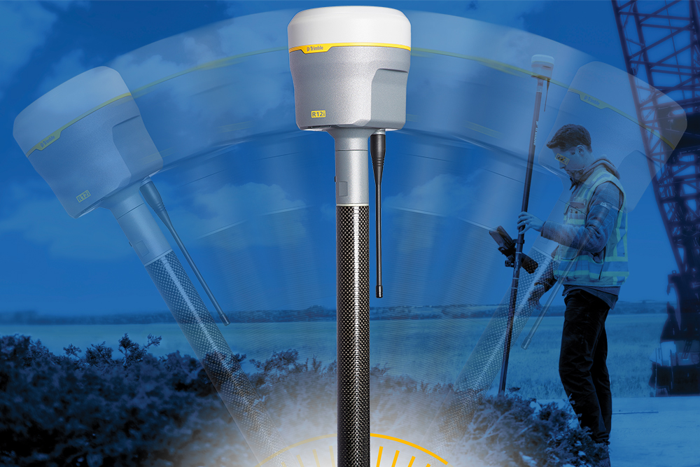
Trimble R12i GNSS receiver incorporates tilt compensation
Austin, Texas, Sept. 1, 2020—Introduced today, the Trimble R12i GNSS receiver is the latest addition to the company’s global navigation satellite system (GNSS) portfolio. The receiver incorporates inertial measurement unit (IMU)-based tilt compensation using Trimble TIP technology, which enables points to be measured or staked out while the survey rod is tilted.
The tilt compensation capability builds on the company’s ProPoint GNSS positioning engine, which offers flexible signal management that enables the use of all available GNSS constellations and signals. In addition, the engine enables new TIP technology. The company’s TIP technology allows users to mark and measure points in areas previously inaccessible for GNSS rovers such as building corners, or in hazardous situations, for example the edge of an open excavation.
The receiver operates calibration-free out of the box and is resistant to magnetic interference from sources such as cars or electrical utility boxes. The R12i’s real time automatic inertial navigation system (INS) integrity monitoring can detect and correct for IMU biases introduced by use over time, temperature or physical shocks, helping ensure measurement quality and integrity for the life of the receiver.
The Trimble R12i GNSS System is now available through AllTerra Central.
AllTerra PR Release November 5, 2019
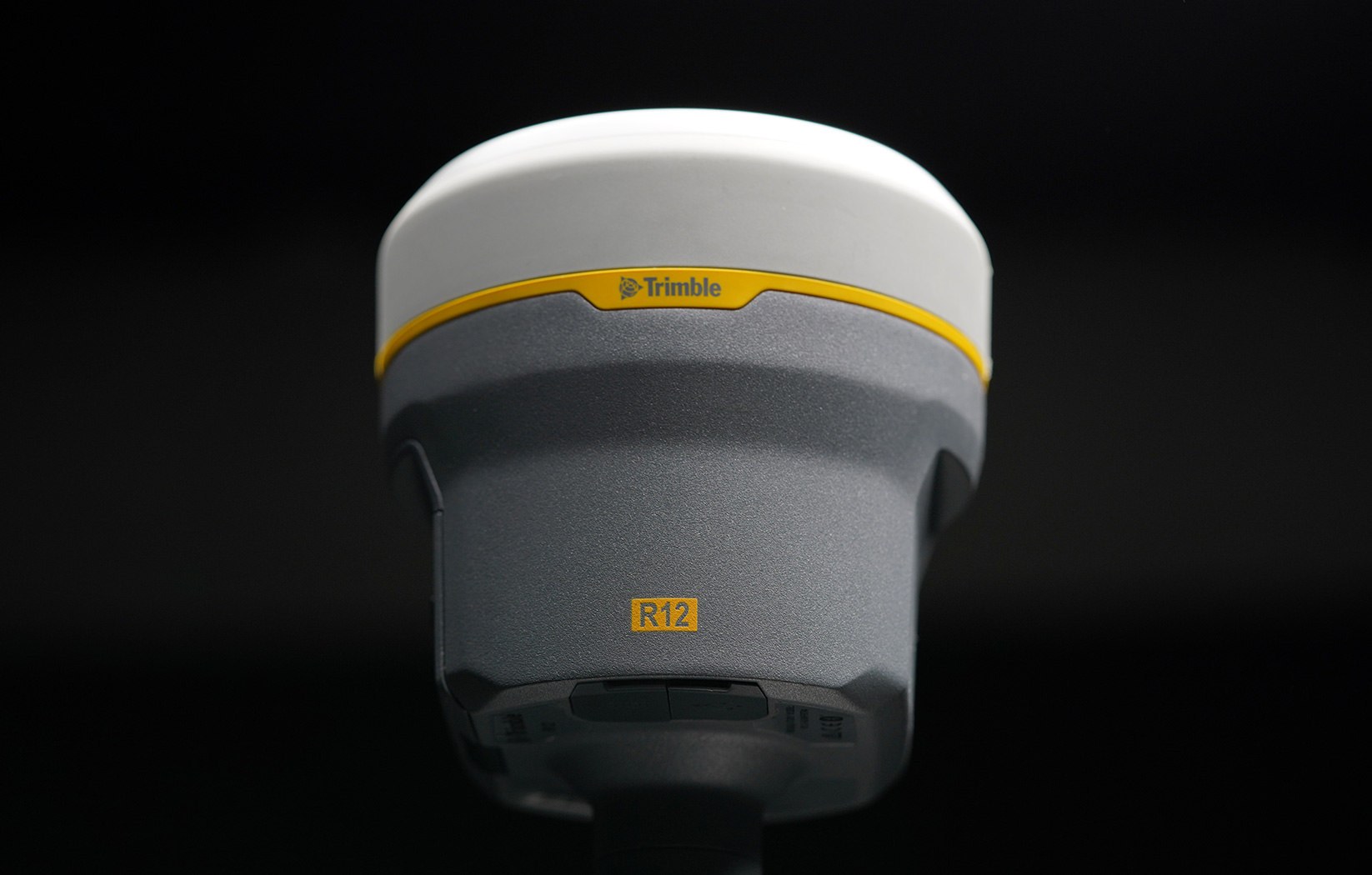
New Trimble R12 Receiver Boosts Surveying Performance
Advanced RTK Engine Delivers Increased Accuracy and Productivity in Challenging GNSS Environments
Austin, Texas, Sept. 1, 2020—Introduced today, the Trimble R12i GNSS receiver is the latest addition to the company’s global navigation satellite system (GNSS) portfolio. The receiver incorporates inertial measurement unit (IMU)-based tilt compensation using Trimble TIP technology, which enables points to be measured or staked out while the survey rod is tilted.
The tilt compensation capability builds on the company’s ProPoint GNSS positioning engine, which offers flexible signal management that enables the use of all available GNSS constellations and signals. In addition, the engine enables new TIP technology. The company’s TIP technology allows users to mark and measure points in areas previously inaccessible for GNSS rovers such as building corners, or in hazardous situations, for example the edge of an open excavation.
The receiver operates calibration-free out of the box and is resistant to magnetic interference from sources such as cars or electrical utility boxes. The R12i’s real time automatic inertial navigation system (INS) integrity monitoring can detect and correct for IMU biases introduced by use over time, temperature or physical shocks, helping ensure measurement quality and integrity for the life of the receiver.
The Trimble R12i GNSS System is available through AllTerra Central.
Austin, Texas, Nov. 5, 2019—AllTerra and Trimble introduced today the Trimble® R12 GNSS receiver, a high-performance Global Navigation Satellite System (GNSS) surveying solution. Powered by an all new Real Time Kinematic (RTK) and Trimble RTX® positioning engine, it features ground-breaking Trimble ProPoint™ GNSS technology that empowers land surveyors to quickly measure more points in more places than ever before. Surveyors who work in challenging GNSS environments can use the Trimble R12 receiver to help reduce both the time in the field and the need for conventional techniques such as using a total station.
The new state-of-the-art Trimble ProPoint GNSS technology allows for flexible signal management, which helps mitigate the effects of signal degradation and provides a GNSS constellation-agnostic operation. In head-to-head testing with the Trimble R10-2 in challenging GNSS environments such as near and among trees, and built environments, the Trimble R12 receiver performed more than 30 percent better across a variety of factors, including time to achieve survey precision levels, position accuracy and measurement reliability.
"As a leader in the field of GNSS technology and innovation, Trimble dedicated many years of intensive research into developing the Trimble R12," said Ronald Bisio, senior vice president of Trimble Geospatial. "This has culminated in a first-class solution, which enables our users to extend the reach of their systems to places where other RTK GNSS systems experience degraded performance."
AllTerra PR Release September 16, 2019
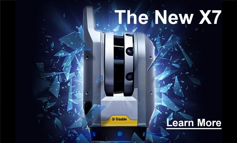
Trimble Blends Performance and Simplicity with New X7 3D Laser Scanning System
Innovative High-Speed 3D Laser Scanning System Simplifies Use, Increases Efficiency and Provides Confidence in the Field to Capture Digital Data
Austin, Texas, Sept. 16, 2019 - AllTerra Central and Trimble introduced today the Trimble® X7 3D laser scanning system, enabling professionals of all scanning levels to quickly and easily capture precise 3D scanning data to produce high-quality deliverables. Ideal for surveying, construction, industrial and forensic applications, the Trimble X7 3D laser scanner is an integrated solution with specialized field software, featuring:
-Simple and streamlined workflows to provide automatic registration of point cloud data in the field with Trimble Registration Assist
-Smart Trimble X-Drive technology to eliminate the need for annual calibration
-Survey-grade self-leveling to ensure consistent data quality
-Professional quality and sturdy IP55 rating backed by an industry leading two-year warranty
-Smart Trimble X-Drive technology to eliminate the need for annual calibration
-Survey-grade self-leveling to ensure consistent data quality
-Professional quality and sturdy IP55 rating backed by an industry leading two-year warranty
The compact and reliable laser scanner comes with a Microsoft® Windows®-based Trimble T10 ruggedized tablet for control and project visibility, along with a backpack and lightweight tripod for portability.
"The Trimble X7 delivers high-speed 3D laser scanning with intuitive workflows and unique technologies automating critical steps, which improves efficiency and productivity," said Gregory Lepere, marketing director, optical and imaging for Trimble Geospatial. "The X7 is a useful, everyday tool because it doesn't require scanning expertise to operate. It opens the door for more construction, surveying, industrial and forensics professionals to confidently capture and deliver scan data and realize a faster return on investment."
Trimble X7 for Surveying
For surveyors and geospatial professionals, the X7 provides fast and balanced performance in both indoor and outdoor environments and is ideal for industrial survey/tank calibration, civil infrastructure, general surveys, road intersection surveys, utilities, mining and historical documentation and renovation.
The Trimble X7 solution is fully integrated with the new Trimble Perspective software specifically designed for in-field control and complete registration. The combination enables scans and images to be captured, fully registered together, refined, controlled and exported to a variety of established data format for Trimble and non-Trimble software suites.
Trimble X7 for Building Design and Construction
For users in building design and construction, the X7 provides answers to the complex measurement problems of existing conditions and improves field productivity for a broad range of applications in architecture, engineering and construction (AEC) industry projects, including concrete; mechanical, electrical and plumbing (MEP); and general contracting; as well as quality assurance validation in steel prefabrication.
The X7 solution is fully integrated with Trimble Field Link software to provide streamlined workflows specific to the building construction industry—from scanning to modeling to field layout. The solution also includes a first-of-its-kind laser pointer using scan data to improve communication between stakeholders and reduce rework.
Trimble X7 for Forensics
For law enforcement, tragic events can happen anywhere and anytime. The X7, developed with feedback from law enforcement, can perform in demanding conditions such as cold and rain, day or night. Ease of use from field setup to automatic registrations ensures that investigators remain focused on gathering the evidence and building solid cases. The X7, supported by Trimble Forensics Capture software, is a complete solution for Forensics investigators.
AllTerra PR Release September 16, 2019

Trimble's New High-Accuracy Handheld Augmented Reality System Takes Data Visualization Outdoors
Trimble SiteVision Provides an Innovative Way to Visually Explore and Understand Complex Information
Austin, Texas, Sept. 16, 2019 - Trimble (NASDAQ: TRMB) introduced today its Trimble® SiteVision™ system, an outdoor augmented reality (AR) solution that enables users to visualize 2D and 3D data on virtually any project site with cellular or internet connectivity for easier and more efficient planning, collaboration and reporting. Combining hardware and software in an integrated, lightweight handheld or pole-mounted solution, users can view 3D models and assets in a real-world environment at a 1:1 scale, from any angle or position.
The system consists of:
Hardware: The Trimble SiteVision Integrated Positioning System integrates the Trimble Catalyst DA1 Antenna, Electronic Distance Measurement (EDM) rangefinder and power management into a lightweight, handheld device that connects to a user-supplied Android™ mobile phone.
Software Subscription: Available to single users on a monthly or yearly basis. The SiteVision software subscription combines Trimble's high-accuracy positioning services and cloud-based processing technology to create a centimeter-accurate AR system. The system leverages Trimble cloud-based processing to manage and deliver data and design models.
SiteVision enables users to visualize digital models from a wide range of data collection, design and constructible modeling tools in open industry-standard formats including IFC and LandXML. For civil projects, SiteVision accurately visualizes data from Trimble's Quantm, Business Center and Novapoint; design data from Civil 3D® and Bentley® OpenRoads; and GIS data from Esri® ArcGIS® software. SiteVision powers Building Information Modeling (BIM) projects with open data from Trimble's Constructible BIM solutions including SketchUp and Tekla, and BIM data from Autodesk Revit® and AutoCAD® software. For utility companies, PLS-CADD™ power line design, Distribution Design Studio (DDS) and other industry-specific design data is also supported.
Using Trimble Connect™ cloud-based hosting, SiteVision can access models from all stages of the lifecycle of infrastructure and buildings—from initial concepts of roads or buildings through the operations and maintenance phase of the assets—to increase collaboration, enhance work accuracy and ultimately improve operations and utilization.
SiteVision simplifies complex concepts by allowing users to blend digital content with real-world environments. For example, city planners can visualize a new building design in the exact spot it is to be erected, a work crew could identify the exact position of underground cables or pipes before digging, an electric utility can confirm placement of poles and lines with customers and crews, or a construction supervisor could assess the progress of heavy equipment by visualizing actual work performed against the site plan.
"It's easier to understand complex ideas when we can see them in a real-world context," said Mark Nichols, general manager at Trimble. "SiteVision improves our understanding of projects and worksites with a handheld device that is accessible to a wide range of users. Augmented reality is now ready for everyday use in a wide range of applications."
AllTerra PR Release May 21, 2019

Trimble Releases Next-Generation Integrated Smartphone and GIS Data Collector - The TDC600 Handheld
Professional GNSS Performance in a Rugged Smartphone
Austin, Texas, May 21, 2019 - Trimble (NASDAQ: TRMB) introduced today the Trimble® TDC600 handheld, an ultra-rugged, all-in-one smartphone and Global Navigation Satellite System (GNSS) data collector for Geographic Information System (GIS) and field inspection applications. The next-generation smartphone data collector boasts an Android™ 8.0 operating system, bright sunlight-readable 6-inch display, powerful 2.2 GHz processor, 4 GB memory and an enhanced capacity all-day battery.
Built for GIS users in organizations across a variety of industries, including environmental management, utilities and government agencies, the TDC600 handheld is the ideal tool for communicating between the field and office. With Wi-Fi, Bluetooth® 4.1 and 4G LTE cellular connectivity that supports data and voice calls, field workers are able to use the TDC600 as they would any consumer smartphone. Users can make calls, send text messages and emails and access the internet—removing the need for multiple devices in the field. Featuring a slim, lightweight and ergonomic pocket-size form factor, the TDC600 easily fits in a user's hand with a fitted strap providing extra security while on the job. Constructed to meet military (MIL-STD-810G) specifications, the durable design absorbs drops and shocks, and works in harsh weather conditions, without the need for a protective case.
The TDC600 integrates seamlessly with Trimble's data collection applications—Trimble TerraFlex™ software and Trimble Penmap® for Android software—as well as third-party apps such as Esri® Collector for ArcGIS®. With its Google Mobile Services certification, users can run Google core applications and access apps on the Google Play Store for personalization of their device.
More powerful and with a longer lasting battery than its predecessor, the TDC600 handheld supports the Trimble Catalyst™ GNSS positioning service that delivers subscription-based accuracy on demand for Android devices. In addition, the TDC600 can be used with external receivers such as the Trimble R2 and R1 GNSS receivers, and also features a built-in GNSS receiver that supports GPS, GLONASS, and BeiDou constellations plus Satellite-Based Augmentation System (SBAS) capabilities for real-time positioning.
"The global mobile workforce is growing and field personnel are constantly tasked with capturing and computing large amounts of data in more places with greater accuracy, requiring powerful and reliable data collection methods," said Rachel Blair-Winkler, business area manager for Trimble Mapping & GIS. "A professional turnkey solution such as the TDC600 handheld running Trimble data collection apps paired with the Trimble Catalyst service fulfills this requirement. Our customers now have a powerful, comprehensive and cost-effective entry level system to collect and retrieve highly accurate GIS data virtually anywhere in the world."
PR Release January 17, 2018
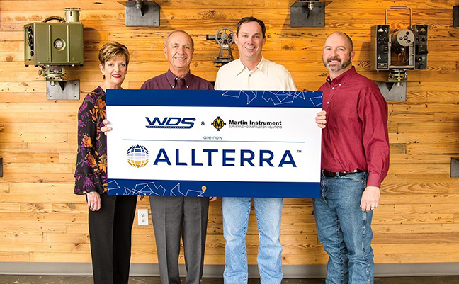
In the photo (from left to right): Wendy and Mike Hefer, owners of WDS, join Martin Instrument's President Bobby
Hempfling and Vice President Mike Minick in announcing the merger.
Martin Instrument and WDS announce merger to create AllTerra Central
Combined company will drive technological innovation, addressing the needs of surveying, mapping, engineering and construction industries
AUSTIN, Texas, Jan. 18, 2018 - Martin Instrument and Western Data Systems (WDS) today announced that the companies have completed a merger agreement to create AllTerra Central. The combined staff will allow AllTerra Central to better focus on bringing Trimble Optical, GNSS and GIS solutions and complete field supply availability to the Surveying, Mapping, Engineering and Construction markets across Texas and Oklahoma. The Management team will be headed up by Bobby Hempfling as President and Mike Minick as Vice President, with continued operation supported by the all the great employees of both companies.
“Both of our companies have prospered for more than 25 years because of their technical knowledge, strong customer relationships and focus on great customer service. When the opportunity became available to merge the talents of both, everyone involved knew that something incredible would result. This company will be unstoppable in providing support and high-tech solutions to the industry,” said Hempfling.
The new AllTerra Central will be headquartered in Austin, TX, with locations in Houston, Dallas/Ft Worth, San Antonio, McAllen, Oklahoma City and Midland/Odessa.
“We have long admired Bobby and Mike and the incredible success story they have created at Martin Instrument. I strongly support the AllTerra vision for the future and the culture of innovation and great customer service," said Michael Hefer, owner of WDS.
AllTerra Central will continue to provide sales of both new and used equipment, service centers to repair that equipment, and rental/leasing services to various industries/municipalities. Additionally, it will operate the most complete VRS network in TX and OK, and will continue to serve customers with a robust online solution - allowing easy access to products, services, and information to everyone.
For questions about this exciting news, please contact Bobby Hempfling at 512-282-4099 or at [email protected]. Or visit www.allterracentral.com.
About Martin Instrument
Martin Instrument is Trimble's Premier Authorized Dealer for Survey Equipment. The team is comprised of highly experienced and dedicated people committed to providing the best knowledge and customer service in the surveying equipment industry. Martin Instrument was founded 23 years ago by Marty and Gina Richardson. Martin Instrument sells new and pre-owned Trimble, Nikon, and Spectra Precision survey products with a large selection of pre–owned GPS Systems, total stations, data collectors, and accessories, available online at martininstrument.com or at our stores in Austin and San Antonio, Texas.
About Western Data Systems
Western Data Systems provides cutting edge positioning technology and solutions to the Geospatial Industries through Trimble Sales, Rentals, Training, Service, and Support of the best products at the best prices. WDS was founded by Michael Hefer in 1983 and is committed to building long‐term personal and professional relationships through genuine concern and appreciation for our customers, our vendors, our company, and our team members: thereby providing opportunities for growth and development for each.
Martin Instrument PR Release May 1, 2017

Surveying All New Territories - Martin Instrument Expanding to All of Texas and Oklahoma
Austin, Texas; May 1, 2017 - Martin Instrument, the premier, authorized Trimble dealer of survey and construction equipment in Austin and San Antonio, Texas, announced today it would be expanding into all of Texas and Oklahoma. “The Martin Instrument team has worked really hard over the past several years taking care of our customers and we are very proud and excited that Trimble has granted us this additional territory,” said Bobby Hempfling, Martin Instrument President. “We’re looking forward to getting out there, meeting people and bringing the same excellent level of customer service to Dallas, Houston and all of Oklahoma.”
Martin Instrument PR Release June 6, 2016

In the photo (from left to right): New owners Mike Minick and
Bobby Hempfling with founders Gina and Marty Richardson
Martin Instrument Announces New Ownership
Austin, TX, June 6, 2016 - Martin Instrument, the premier, authorized Trimble dealer of survey and construction equipment in Texas, has announced Bobby Hempfling and Mike Minick as new owners. Although all of the employees have an equity interest in Martin Instrument, Bobby and Mike are now the majority shareholders and in control of the direction of the company. The new leadership team will assume responsibilities immediately and will succeed Marty and Gina Richardson, who have stepped down to focus their energy on BuildingPoint Texas, a construction technology solution company.
Bobby Hempfling, the new President, has been part of the Martin Instrument team for 11 years, managing the sales department. During that time he has helped grow the revenues of the company more than three fold with his leadership. He will be taking charge of the overall management and strategic direction of the company. Co-owner and new Vice-President Mike Minick, who has been with the company over 12 years, will be in charge of seeking out new business opportunities and managing the company’s new technology expansion into UAV drones and 3D laser scanning.
“We have been so lucky to have had the opportunity to work for Marty and Gina over the years, and in the process have learned a lot about running a small business effectively. Mike and I plan on capitalizing on our past successes and growing the business further with our ability to listen to customers and provide them with the solutions they need,” said Hempfling.