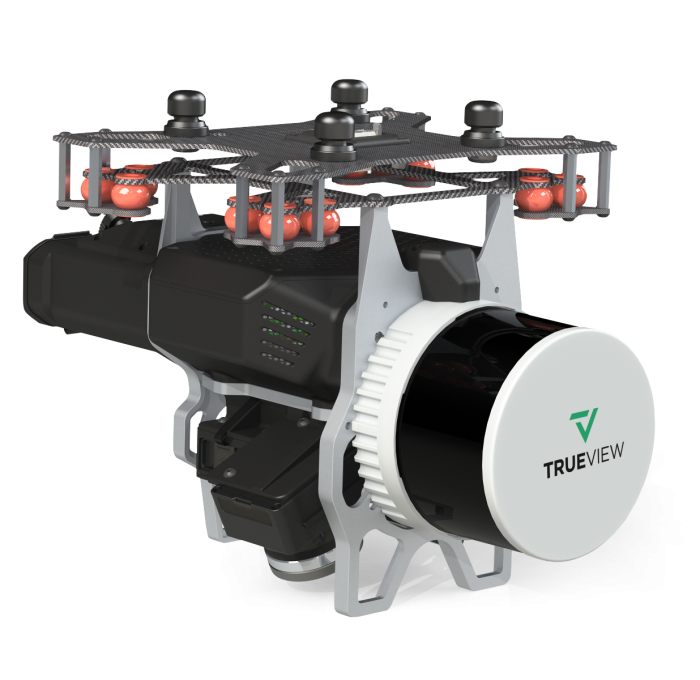
GeoCue's TrueView 535 3D Imaging System
Quick Overview
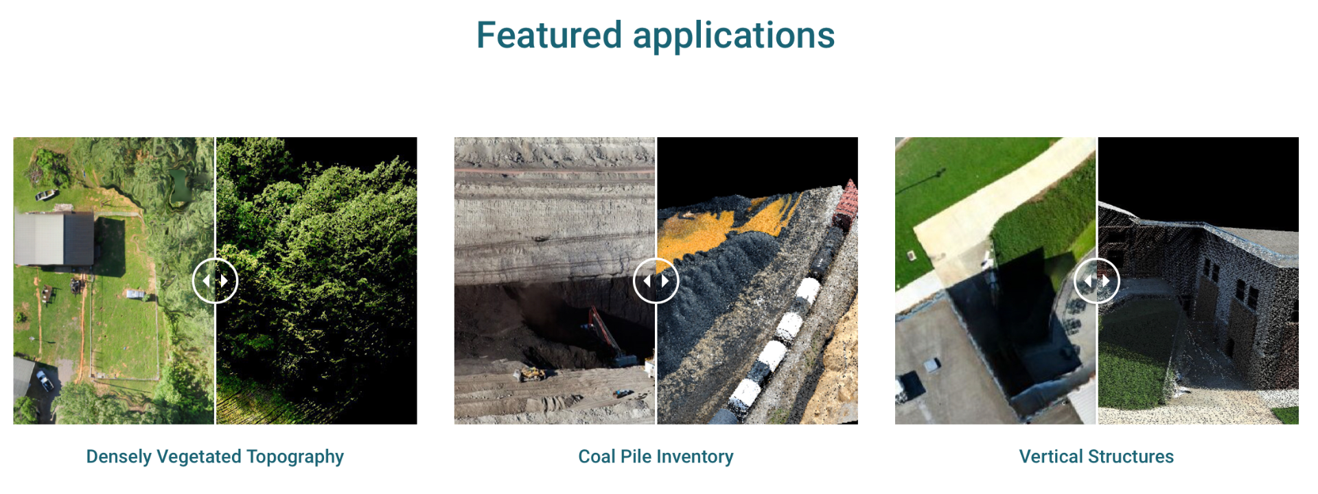
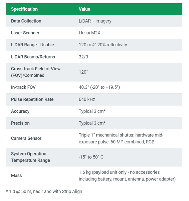
The TrueView 535 builds upon the success of our best-selling TrueView 515. We've added a third LiDAR beam return to improve vegetation capture detail, a third nadir camera to improve photogrammetry deliverables, and a longer usable LiDAR range to increase flexibility.
Highly accurate drone LiDAR & imagery
Drone LiDAR is revolutionizing the way we work, such as creating 3D accurate models and allowing companies to digitize assets like never before. The TrueView™ product series uses a common hardware and software foundation for a family of sensors. The TrueView solution offers innovative drone LiDAR and photogrammetry solutions integrated in lightweight payloads. It allows for fast, easily automated generation of true 3D colorized point clouds, oblique imagery, and orthophotos from a single drone flight.
ONLY AVAILABLE FOR DELIVERY IN TEXAS, OKLAHOMA, NEW MEXICO AND ARIZONA.
SKU
FTV1001002A00T
Special Order

Drone Platforms
Our TrueView 3D Imaging Sensors were designed as a lightweight payload to allow flexible integrations on numerous drone platforms. We have worked with several drone providers to provide customers the complete drone mapping solution they are looking for. Those are DJI, Harris Aerial, Inspired Flight, Skyfront, FreeFLy and Watts Innovations. Company not listed, contact our team and we can discuss custom integrations!