Microdrones LP360 Drone - UAV LiDAR and photogrammetry data processing
Quick Overview
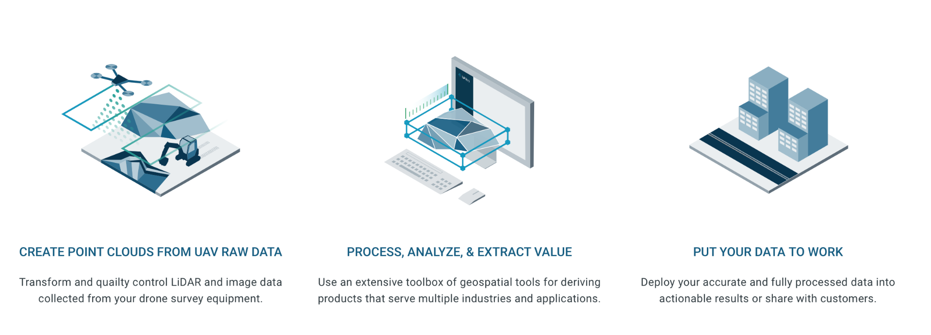
LP360 Drone - UAV LiDAR and photogrammetry data processing
Process, analyze, and maximize drone survey data, producing valuable information and deliverables
Drone LiDAR and photo processing workflow made simple
- Intuitive workflow
- Multi-flight import and processing
- GIS interface allowing combination with other geospatial data
- Powerful point cloud visualization with multiple and synchronized windows
ONLY AVAILABLE FOR DELIVERY IN TEXAS, OKLAHOMA, NEW MEXICO AND ARIZONA.
SKU
SFW1000652A00N
In stock

Process and improve quality of your DJI L1 data
LP360 Drone enhances data from your DJI (P1, L1, P4 RTK, M200 RTK, Zenmuse X4S, and X7S). We start where DJI Terra software ends. Produce final deliverables, including DTM, one-foot contours, classified point cloud, and volumetrics. Step-by-step workflow to:
- Manage extensive list of coordinate systems
- Separate LAS files by flight lines
- Strip align for geometric correction (optional add-on)
- Smooth data
- Add GCPs for data QC
- Access other tools of LP360 Drone
Improve your data quality
- Strip align your data for geometric correction (optional add-on)
- Smooth your data to increase precision
Manage your coordinate systems
- Extensive list of coordinate systems available
- Allow datum transformation including epoch change
- Allow reprojection
- Local site calibration
- Grid to ground
LPLAS File Format: Improve the viewing experience to see all the details that you need
Intelligently manage the level of detail displayed in your project. Smart technology ensures that you always have the best view of your geospatial subject possible, within LP360. Best of all, LPLAS is still backwards compatible and can be opened up in any application that opens LAS files.
When an LPLAS file is opened in LP360, you enjoy the added functionality of this optimized viewing. In addition, you can open your library of LAS files in LP360, convert them to LPLAS, and breathe new life into your old datasets with enhanced viewing!
IMPORTANT NOTE: An LPLAS file is a LAS file: Extension is *.LAS It is compatible with any software that will read an LAS file. It follows the ASPRS standard for the most up to date specification for LAS file.
Leverage your photos with Drone Image Explorer tool
- Explore your data
- Find conjugate images
- Make true measurement on your photos
Simplify workflows into CAD software
- Generate and validate breaklines, enhancing surface for CAD applications
- Reduce dataset for CAD applications
- Export data into CAD software with various CAD formats available
Process your data collected with TrueView and Microdrones sensors
For TrueView and Microdrones sensors, LP360 Drone takes raw flight data and generates colorized, georeferenced 3D LiDAR point clouds. Geotag the imagery collected to create highly accurate orthomosaics. Process without the need to employ other software applications, reducing workflow complexity and time.
3D Accuracy: automated horizontal and vertical checks and corrections of the point cloud
Automated horizontal and vertical checks remove the need for manual interaction
- Automatically transform your check point coordinates into you project coordinates including datum and epoch
- “AutoTarget” – Automatically find a 3D target on a drone dataset
- Calculation of correction for any 3D target
- Seamless workflow to apply the correction on the point cloud
- Use with Accuracy Star ground control equipment, as well as checkboards or concentric targets.
LP360 Photo Add-On
- Ultra-fast ortho mapping from a point cloud
- Create your orthophoto backdrop in a completely integrated workflow
- Efficient fast processing
- Export photo package to your 3rd party Photogrammetry software
- Support most common 3rd party sensors (DJI Mavic 3E, DJI Phantom 4 RTK and DJI Zenmuse P1)