PointMan – Precision Underground Utility Mobile Mapping Software by ProStar
Quick Overview
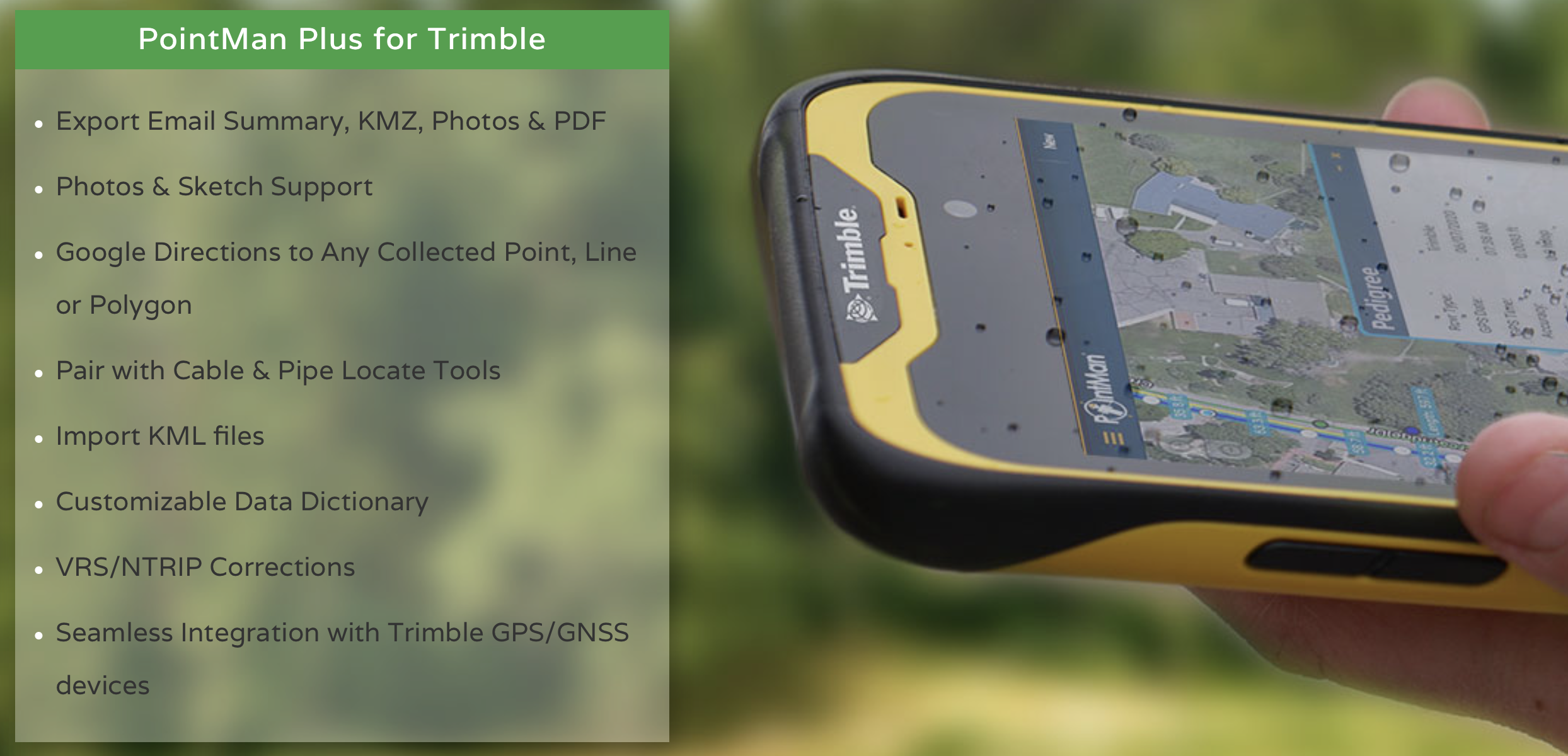
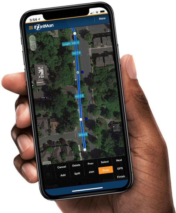
PointMan by ProStar is a patented mobile mapping software application that captures, records, and displays the precise location and the associated metadata to subsurface and surface infrastructure. The data that PointMan captures includes type, depth, accuracy, depth of cover, and precise geospatial location. PointMan can also create and bind forms, sketches, and photos to any point, line, or polygon.
Quickly capture, record, and visualize the precise locations of underground utilities and infrastructure from your mobile device.
- Works with Trimble GPS/GNSS receivers
- Works with RadioDetection and Vivax-Metrotech cable & pipe locators
- Capture quality levels for as-built utilities
- Take photos and digital sketches of the project site
- Customizable data dictionary
ONLY AVAILABLE FOR OUR CUSTOMERS IN TEXAS, NEW MEXICO, OKLAHOMA AND ARIZONA
This is a downloadable product and No Media will be shipped.
(An AllTerra Central Salesperson will contact after purchase and provide an installation code.)
SKU
PointMan
Special Order

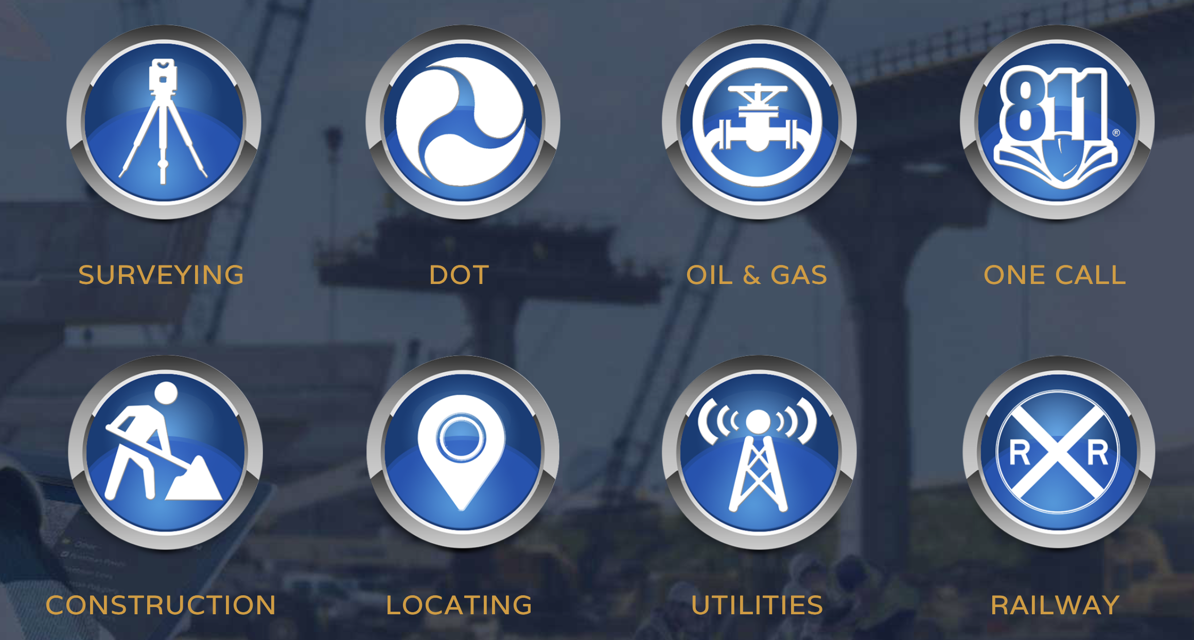
Every minute of every working day underground utility assets are seriously damaged from construction activity. When damage occurs, electrical and communication services are lost, water services are disrupted, gaseous substances are released into the environment and in worse case scenarios there are serious injuries or loss of life. ProStar’s patented Precision Mapping Solutions™ are designed to improve the construction and maintenance of these critical assets and to enhance the safety of the worker, the public and the environment.
Benefits Include:
- Captures the precise location of assets
- Works with all major cable & pipe locators
- Seamless integration with GPS/GNSS receivers
- Improved workflow efficiencies
- Cost-effective
- Maintain regulatory compliance
- Better data visibility
- Maintain complete and accurate records for audits
- Reduced line strikes
- ASCE 38-02 compliant
- Accurate attributes enables improved business decisions
- Modernized software
- Real-time Cloud Sync
- Improved communications across all stakeholders
- High ROI for collecting survey-grade data
- US-based customer support
- Easy to manage licensing