TBC Module - Aerial Photogrammetry Module – Perpetual License
Quick Overview
Manage aerial survey and mapping projects from fly to finish. The Trimble® Business Center (TBC) aerial photogrammetry solution brings advanced aerial photogrammetry workflow capabilities together with existing survey workflow and data processing features. Process + create deliverables with Trimble + third-party UAS data in TBC + UASMaster. Note: Each Trimble® Business Center (TBC) Module is designed to support a group of workflows around a single topic. Modules are add-ons to an edition of Trimble Business Center.
ONLY AVAILABLE FOR OUR CUSTOMERS IN TEXAS, OKLAHOMA AND ARIZONA
Trimble Business Center Aerial Survey - Perpetual License.
This is a downloadable product and No Media will be shipped.
(An AllTerra Central Salesperson will contact after purchase and provide an installation code.)
SKU
63616-00
In stock
$5,495.00

UAV INTEGRATION:
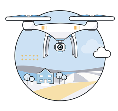
With Trimble Business Center hardware support of industry-leading manufacturers of UAV systems-such as DJI, Microdrones, senseFly, and more-you can easily import aerial photogrammetry project data.
Through the seamless import of UAV data in TBC, the necessary metadata, such as the camera and UAV model and GNSS quality, will automatically be read after the transfer of the image folder into TBC. This will then be used in the next processing steps.
STREAMLINED WORKFLOW:
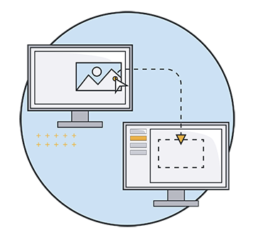
With Trimble Business Center software you benefit from an all-in-one aerial photogrammetry software solution that takes you through a clear three step approach to move from import to final deliverable of an aerial photogrammetry project with ease.
Workflow highlights:
- Original Ground Topography-Create highly accurate topographic and contour maps for existing grade tie-ins and site preparations.
- As-Built Topography-Capture accurate vertical or earthwork conditions for validation+ prove it with detailed adjustment reports.
- Volume Quantities-Save time and money, in the field and office, with quick, repeatable and accurate stockpile computations.
- Inspection & Change Detection-Leverage new heat mapping comparison, feature extraction and visual inspection tools to optimize aerial photogrammetry point clouds and orthomosaics.
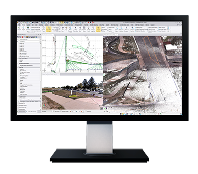
FAST ADJUSTMENT & HIGH-QUALITY DELIVERABLES:
The Trimble Business Center Aerial Photogrammetry module reduces data processing time without compromising on quality of point clouds and orthophoto deliverables.
- Quick Image Adjustment and Processing-Reduce the amount of time spent waiting for deliverables with a performance engine with more than 25% faster production compared to similar products on the market.
- Improved Deliverable Quality-Generate more detailed and accurate orthophotos and high-quality dense point clouds to achieve better linework and more accurate basemaps.
ALL-IN-ONE PLATFORM:
With Trimble Business Center, manage all your aerial photogrammetry, survey, and construction data within one software platform. Reduce the time and cost of multiple software solutions for your projects.
As the leading provider of comprehensive coordinate systems and geodetic transformations. TBC ensures that you have access to the essential tools necessary for project success.