Juniper Systems Uinta Mapping and Data Collection software
Quick Overview
Tired of complex and expensive GIS mapping software with limited abilities to customize for your job? We were too. Train new users in minutes with Uinta mapping and form data collection software. Available for Windows™ and Android™.
TOP FEATURES:
- Efficient Data Capture: Replace paper forms with efficient electronic data entry forms, for use with or without maps
- Professional Mapping: Quickly map points, lines, and areas. High-accuracy mapping supported
- Customizable: Create custom project templates so field-collected data reflects your job(s)
- User-friendly: Simple interface allows users to be trained and collecting data in minutes
- Sharable: Export data to a file, print professional PDF map reports, and create optional cloud projects
- Free & Live Support: Get a jump start on your project with help from Juniper Systems' in-house customer success team
This is a downloadable product and No Media will be shipped.
(An AllTerra Central Salesperson will contact after purchase and provide an installation code.)
SKU
29117-UINTA
Special Order
$500.00

A 1-year Uinta Pro license costs $500/year and supports use on two Windows 10 devices (e.g., desktop plus windows or android field license). Additional users can be added for $250/year - SKU: 29119
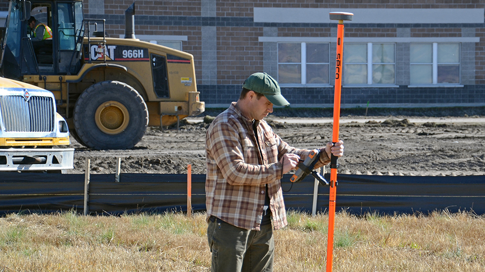
UTILITY MAPPING
High-accuracy utility asset mapping continues to be one of the most popular applications of the Uinta Data Collection Software. Map general utility asset points, such as transformers, manholes, valves, electric lines, fiber optic lines, and gas lines. The project template includes standard utility color codes for each point, line, and area. Once complete, users can print professional PDF map reports and share GIS files with customers.
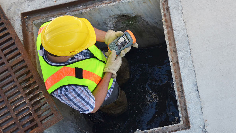
LOCAL GOVERNMENT ASSET MANAGEMENT AND MAPPING
Managing public assets? Try this municipal sample template. This template includes forms for typical assets, such as maintenance, parks, and utilities. Forms can be used as a start and easily modified to reflect specific needs. Export data to file formats that easily import into any GIS system.
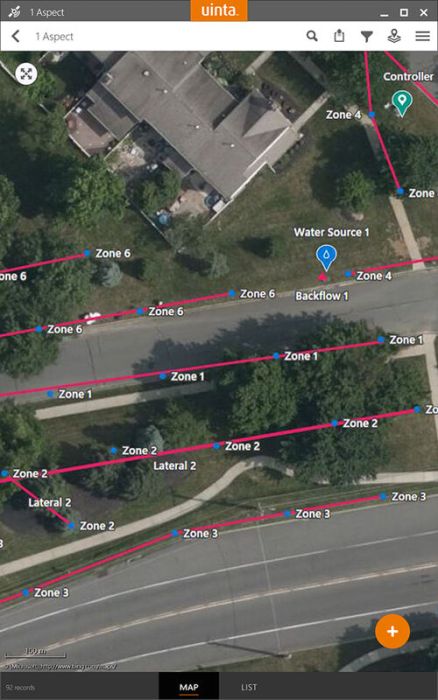
COMMERCIAL IRRIGATION MAPPING AND WATER AUDITS
Map typical irrigation features, such as valves, control heads, main lines, laterals, and zones. Uinta works as a powerful tool to map as-builts and to perform surveys of broken irrigation assets or water audits. Print professional PDF map reports, including equipment lists and photos, to share with customers.
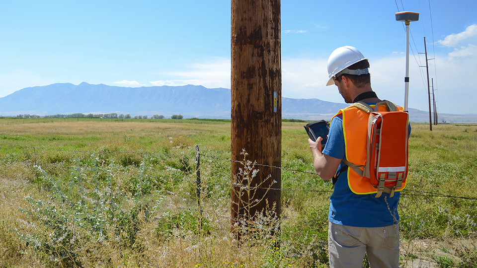
UTILITY POLE MAPPING AND INSPECTION
Inspecting and mapping utility poles? Consider using one of several custom templates designed to quickly map and add pole data, including attached asset heights, midspans, photos, and pole status. Forms can be quickly modified to match specific job
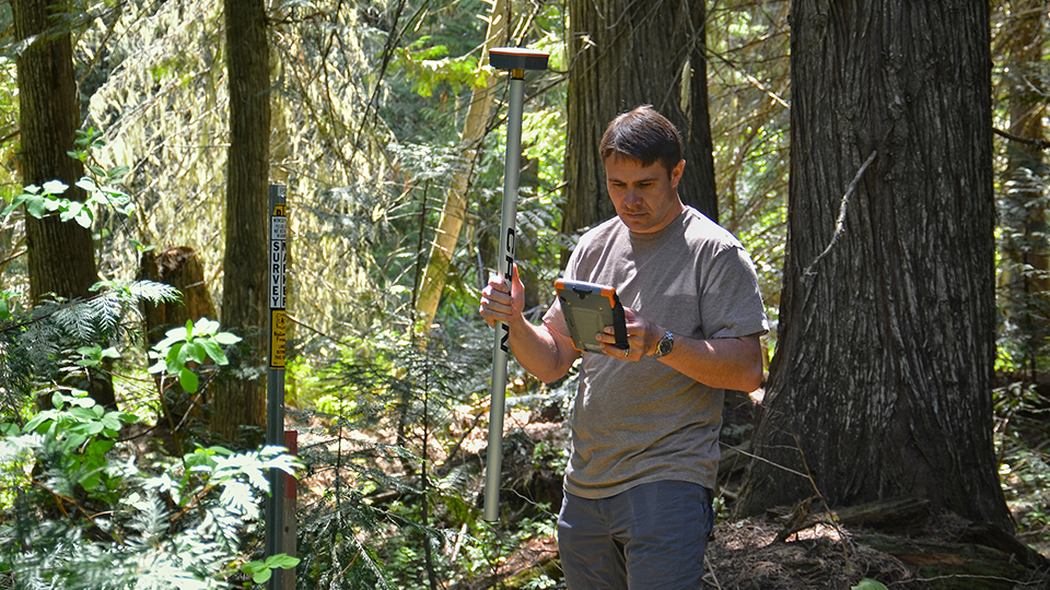
NATURAL RESOURCES
Juniper Systems’ roots run deep in natural resources. In fact, it’s how Juniper got its start. Uinta Data Collection Software is designed to support a broad range of use cases within natural resources. Sample templates are available for range management, environmental consulting, wetland delineations, archaeological surveys, wildlife surveys, and geological sampling.
INDUSTRIAL ASSET INSPECTIONS
Are you responsible for managing industrial assets? Uinta Data Collection Software can be configured for inspection rounds, tracking assets, and to prove asset status for regulatory requirements. Sample templates can be used as a starting point to customize for your specific job with or without map requirements.
HARBOR MOORING LAYOUT PLAN AND NAVIGATION
Are you a harbor master, marina contractor, or engineer responsible for mooring placements and other harbor assets? Uinta Data Collection Software, combined with Juniper Systems' high-accuracy Geode Real-time Sub-meter GPS Receiver, is a solid solution for navigating to planned mooring locations and accurately placing buoys. No more phone calls in the middle of the night because boats are banging into each other.