877.309.4099
 Contact Sales
 877.309.4099
 Contact Sales
-
LP360 Drone - UAV LiDAR and photogrammetry data processingProcess, analyze, and maximize drone survey data, producing valuable information and deliverables Drone LiDAR and photo processing workflow made simple Intuitive workflow Multi-flight import and processing GIS interface allowing combination with other geospatial data Powerful point cloud visualization with multiple and synchronized windows ONLY AVAILABLE FOR DELIVERY IN TEXAS, OKLAHOMA, NEW MEXICO AND ARIZONA. CONTACT SALESPERSON HEREQuote Now
-
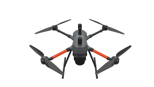
MICRODRONES’ BEST LiDAR PAYLOAD FROM THE 1000 SERIES, NOW AVAILABLE ON OUR NEW AIRFRAME: EasyOneLiDARUHR & UHR LiteSMALLER, SAFER AND EASY TO USE EasyOne LiDAR UHR means ultra-high resolution via a 32-channel LiDAR sensor, fully integrated with an improved 72.5° field of view camera. This translates to more point density, better detail, and improved deliverables. The survey equipment, LP360 Drone software, workflow, training, and support work together to make you more productive than ever. Built upon Microdrone’s 4th-gen drone technology, all EasyOne systems are more compact, more optimized, lighter, safer and more efficient. This system delivers integration unmatched in the drone surveying industry, making it easier than ever for you to plan, fly, collect, process and visualize your geospatial data projects. It includes a perpetual license of LP360 Drone software for post-processing your data. LP360 Drone is a powerful ecosystem that will enable you to quickly and efficiently process geospatial data. Your system will include LP360 Drone, as well as Strip Align and Desktop Photo Add-Ons. Don’t need the full resolution of 32-channel UHR? We offer a cost competitive UHR Lite configuration, delivering 16 channels of LiDAR that can easily be upgraded later via a firmware update. ONLY AVAILABLE FOR DELIVERY IN TEXAS, OKLAHOMA, NEW MEXICO AND ARIZONA. CONTACT SALESPERSON HEREQuote Now
-
THE MOST COMPACT SURVEY-GRADE DRONE LiDAR SURVEYING EQUIPMENT ON THE MARKET: EasyOneLiDARUHR+ EasyOne LiDAR UHR+ offers some significant upgrades to the UHR and UHR Lite. The Hesai Pandar M2X sensor adds an additional return for impressive density and 40 m of increased range while holding the same accuracies. ultra-high resolution via a 32-channel LiDAR sensor, fully integrated with an improved 72.5° field of view camera. This translates to more point density, better detail, and improved deliverables. The survey equipment, LP360 Drone software, workflow, training, and support work together to make you more productive than ever. Built upon Microdrone’s 4th-gen drone technology, all EasyOne systems are more compact, more optimized, lighter, safer and more efficient. This system delivers integration unmatched in the drone surveying industry, making it easier than ever for you to plan, fly, collect, process and visualize your geospatial data projects. It includes a perpetual license of LP360 Drone software for post-processing your data. LP360 Drone is a powerful ecosystem that will enable you to quickly and efficiently process geospatial data. Your system will include LP360 Drone, as well as Strip Align and Desktop Photo Add-Ons. ONLY AVAILABLE FOR DELIVERY IN TEXAS, OKLAHOMA, NEW MEXICO AND ARIZONA. CONTACT SALESPERSON HEREQuote Now
-
Introducing the mdLiDAR 1000HR aaS payload. By combining the robust and field proven md4-1000 airframe, with a fully integrated high-resolution LiDAR & camera payload from Velodyne, the mdLiDAR1000HR can capture ultra-dense LiDAR data quickly and safely in the field. The Velodyne LIDAR payload utilizes the new Puck Lite sensor which offers increased range and field of view. HR means high resolution point clouds and increased coverage is made easier and more accessible than ever. This includes the mdLiDAR 1000HR Payload which is compatible with the md4-1000 platform (Versions C and D). Includes a 30-Day Warranty. CALL 877-300-9659 if you have any questions (mention you saw it on the website). Microdrones mdLiDAR 1000HR aaS Payload Includes: Microdrones mdLiDAR 1000HR aaS Payload TCQM (Top Cover Quick Mount) with AV-14 Antenna Microdrones Rugged Transport Case 30-Day Warranty NOT AVAILABLE FOR DELIVERY IN CALIFORNIA.Quote NowSale
-
Microdrones Payload mdMapper 1000DG aaS will help you to achieve high levels of data accuracy, cover more ground in one flight, use less people and equipment on jobs – all without using ground control points. Significantly reduce your time spent on projects. Deliver unparalleled data quality. Become invaluable to your clients’ success. This includes the mdMapper 1000DG Payload which is compatible with the md4-1000 platform (Versions C and D). Includes a 30-Day Warranty. CALL 877-300-9659 if you have any questions (mention you saw it on the website). Microdrones mdMapper 1000DG aaS Payload Includes: Microdrones mdMapper 1000DG aaS Payload Sony RX1R II Professional Compact Camera with 35mm Sensor Sony NP-BX1 Battery Data Transfer Cable SD Card Reader Battery Charger Microdrones Rugged Transport Case 30-Day Warranty NOT AVAILABLE FOR DELIVERY IN CALIFORNIA.Quote NowSale

Item added to your cart