 877.309.4099
 Contact Sales
 877.309.4099
 Contact Sales


Aerial Imaging
Wingtra Ray SURVEY 61
Wingtra Ray SURVEY 61
In stock
Share this product


Wingtra Ray SURVEY61
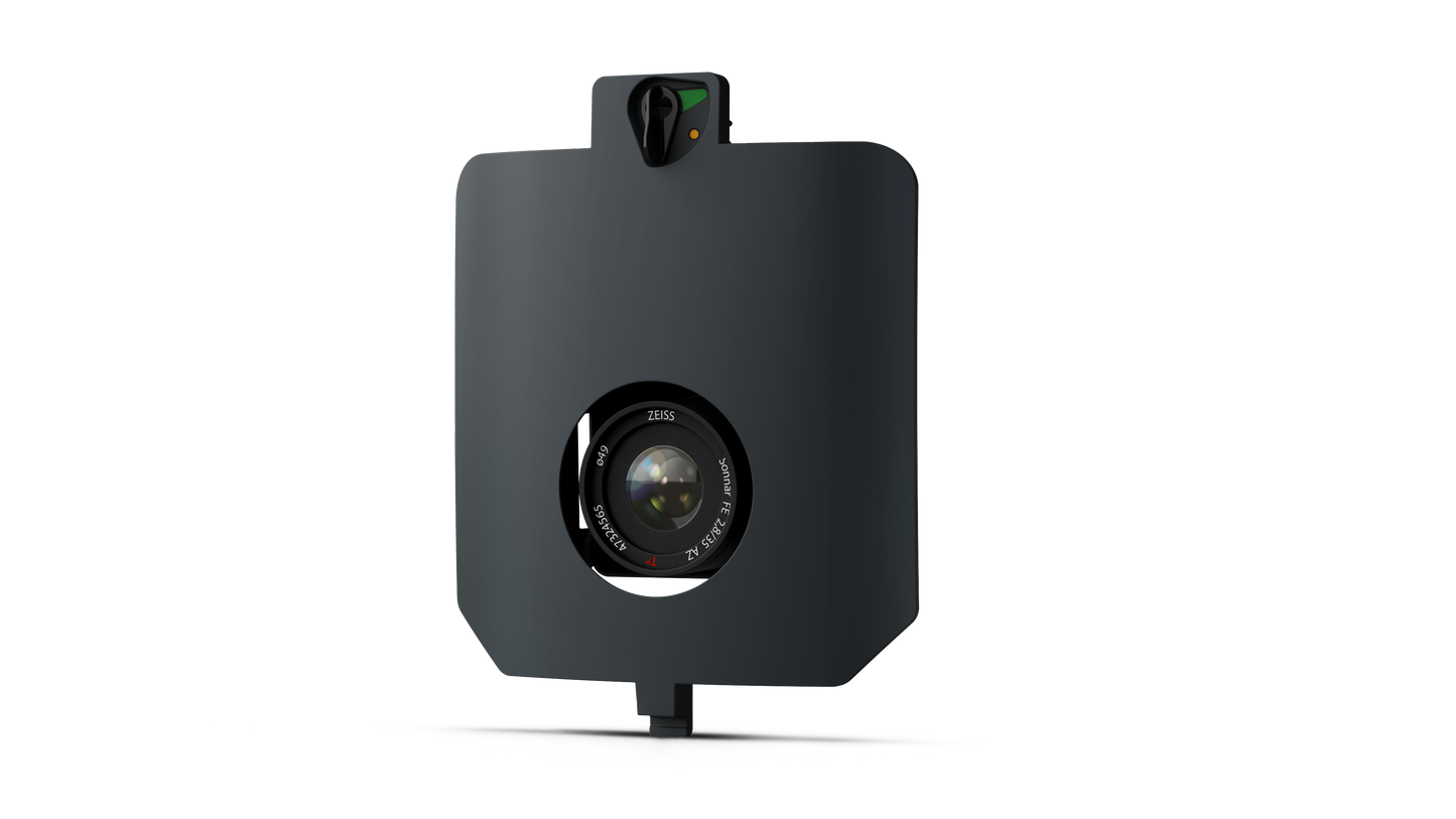
WingtraRAY integrates high-end compact sensors from Sony. They allow you to capture the sharp images and fine details that are required for the most demanding aerial mapping applications.
A GCP-free workflow you can trust to deliver survey-grade accuracy
Traditional photogrammetry relies on ground control points (GCPs) to correct errors from camera geometry, image timing, and positioning uncertainty.
With SURVEY61, you rely on precise image geotagging and a few independent checkpoints to verify accuracy and deliver survey-grade results.
Survey 6x faster* and save 60% on labor cost
By removing the most time-consuming part of the field work, you no longer need to spend hours placing and measuring dozens of targets across the site, which means:
- 6x faster field work*
- Save 60% on labor costs
- Keep your teams safe from hazard on active sites
*6x less time spent in the field compared to traditional multicopter workflows, achieved through shorter flight and reduction of time spent on Ground Target placement.
Capture active sites and highways without waiver or site shutdowns
With the parachute add-on, WingtraRAY unlocks operations over people, including active construction sites and roads, without stopping work on the ground.
Survey where the work happens without shutting down sites, waiting for waivers or putting ongoing operations at risk.
Frequent surveys for accurate, updated earthworks insights, & stockpile measurements
- High-accuracy topographic surveys, stockpile volumetrics
- Cut costs by 70% on average with repeatable, survey-grade accuracy
- Survey 400 acres, or 4 linear miles per field hour, and schedule more frequent surveys
- Get the most current site view with next-day deliverables thanks to fast processing
- Fly over active sites and highways without waivers or shutdowns with an OOP-approved system
- Trust accurate and reliable stockpile volumes for inventory, billing, and compliance.
- Cut-and-fill progress tracking
- Site planning and grading verification
- Volumetrics reconciliation
- Short-interval change detection
Tech Specs:
Sensor
- 61 MP Full-frame sensor, low-distortion lens (35 mm), nadir configuration
Lowest Possible GSP
- 0.5cm/px at 46 m altitude
Absolute accuracy (RMS x, y, z) with PPK 1
- 3 cm
Max coverage at 120 m
- 310 ha
Wingtra Ray SURVEY61
WingtraRAY integrates high-end compact sensors from Sony. They allow you to capture the sharp images and fine details that are required for the most demanding aerial mapping applications.
A GCP-free workflow you can trust to deliver survey-grade accuracy
Traditional photogrammetry relies on ground control points (GCPs) to correct errors from camera geometry, image timing, and positioning uncertainty.
With SURVEY61, you rely on precise image geotagging and a few independent checkpoints to verify accuracy and deliver survey-grade results.
Survey 6x faster* and save 60% on labor cost
By removing the most time-consuming part of the field work, you no longer need to spend hours placing and measuring dozens of targets across the site, which means:
- 6x faster field work*
- Save 60% on labor costs
- Keep your teams safe from hazard on active sites
*6x less time spent in the field compared to traditional multicopter workflows, achieved through shorter flight and reduction of time spent on Ground Target placement.
Capture active sites and highways without waiver or site shutdowns
With the parachute add-on, WingtraRAY unlocks operations over people, including active construction sites and roads, without stopping work on the ground.
Survey where the work happens without shutting down sites, waiting for waivers or putting ongoing operations at risk.
Frequent surveys for accurate, updated earthworks insights, & stockpile measurements
- High-accuracy topographic surveys, stockpile volumetrics
- Cut costs by 70% on average with repeatable, survey-grade accuracy
- Survey 400 acres, or 4 linear miles per field hour, and schedule more frequent surveys
- Get the most current site view with next-day deliverables thanks to fast processing
- Fly over active sites and highways without waivers or shutdowns with an OOP-approved system
- Trust accurate and reliable stockpile volumes for inventory, billing, and compliance.
- Cut-and-fill progress tracking
- Site planning and grading verification
- Volumetrics reconciliation
- Short-interval change detection
Tech Specs:
Sensor
- 61 MP Full-frame sensor, low-distortion lens (35 mm), nadir configuration
Lowest Possible GSP
- 0.5cm/px at 46 m altitude
Absolute accuracy (RMS x, y, z) with PPK 1
- 3 cm
Max coverage at 120 m
- 310 ha


